
Skip to content
Menu

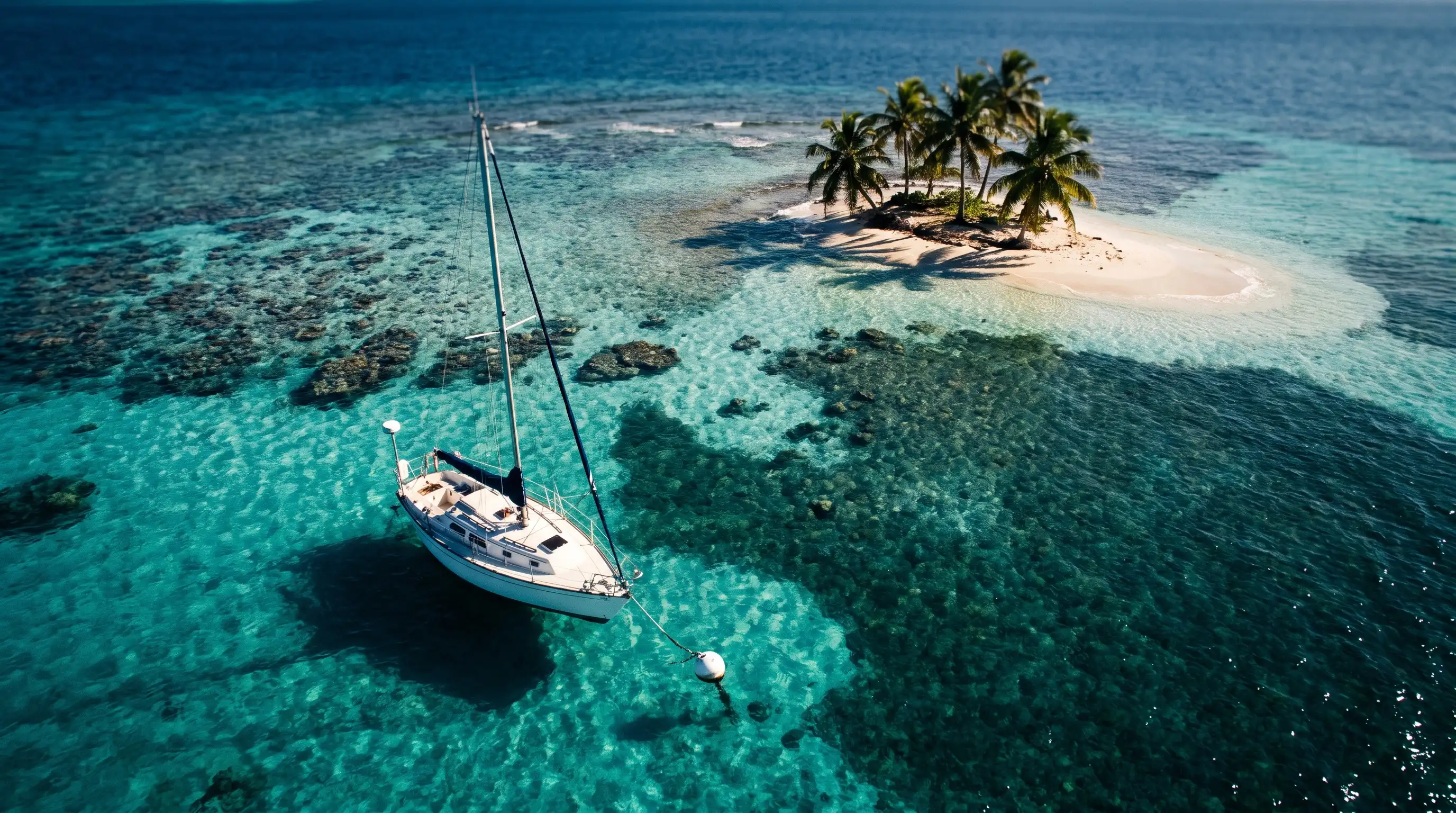
AI-generated illustration

Sea and boating

The sea map

77 spots, islets and moorings: where to put your head underwater, where to tie up (25 places with buoys), what's closed and what the official orders say. The details are in the sea guide.

4 rules to know at sea

  • The 300 m coastal strip: 5 knots maximum near the shore. Jet skis only at right angles to the coast; water-skiing and towed rides banned. prefecture
  • Seagrass beds: never drop anchor on seagrass, only in the sand between patches (order no. 329 of 5 June 2023). order
  • National Park core zone: no anchoring, moor on the Park's buoys (one boat per buoy, daytime only), 3 knots in the Grand Cul-de-Sac Marin zones, no jet skis. order 2021-552
  • Whales and dolphins: never closer than 300 m, by boat, kayak or swimming. If they come towards you, slow down and let them pass. Agoa sanctuary

Base map: IGN Admin Express (Licence Ouverte) · Locations: Parc national de la Guadeloupe, Direction de la mer, towns, ©OpenStreetMap contributors

The spots

Based on official orders, the National Park and the Direction de la mer (maritime authority). Paid buoy prices aren't published everywhere: we give them when an official source does. Buoys and harbour entrances can be sent to a Garmin GPS from each card.

All points in the archipelago (GPX) 268 points (buoys, mooring areas, harbours) in a single file.

Snorkelling from the beach

  • Bouillante Must-see

    Malendure : les tortues sur les herbiers

    Walk in from the sand: seagrass beds at 3-4 m where green turtles graze. Best to head up to the north end of the beach, away from the boats. Don't touch or feed them.

    Directions

    Read moreShow less : Malendure : les tortues sur les herbiers

    SnorkellingTurtlesKayak and paddleboardBoat tripDivingWhales and dolphins

    Access
    From the beach, swimming
    Buoys
    Yes · Commune de Bouillante (municipality)
    Anchoring
    Regulated
    Landing
    Allowed
    Level
    Beginner
    • Sea turtles are protected: capturing them, disturbing them intentionally, and destroying their eggs/nests and habitats are banned (ministerial order of 14 October 2005). source
    • Anchoring banned on seagrass beds in internal waters; drop anchor in the sand between the seagrass beds (prefectoral order no. 329 of 5 June 2023, DM). source
    • 300 m coastal strip: speed limited to 5 knots; personal watercraft only on a course perpendicular to the shore; water-skiing, towed devices and parasailing banned (prefectoral order no. 2018-116 of 10 July 2018). source
    See the 1 other rules
    • Bouillante ZMEL (Malendure and Bourg sites) approved by inter-prefectoral order of 17 June 2025: 71 mooring spots, 63 of them laid in July 2026 (press reports).
    • Main departure point for boats to the îlets Pigeon: keep clear of the boats' mooring area/channel in front of the beach.
    • Little swell or current in normal conditions, but check conditions before going into the water.
    • Departure point for trips to the îlets Pigeon: heavy dive-boat traffic. source

    In our guides: The Guadeloupe sea guide

    Picked by our editors, not yet tested on site.

  • Bouillante

    Petite Anse (Bouillante)

    Small beach in the south of Bouillante, just north of Anse à la Barque. Rocky reef and seagrass down to ~6 m, green turtles are frequent. The car park fills up fast.

    Directions

    Read moreShow less : Petite Anse (Bouillante)

    SnorkellingTurtles

    Access
    From the beach, swimming
    Buoys
    Yes · Parc national de la Guadeloupe source
    Level
    Beginner
    • Sea turtles are protected: capturing them, disturbing them intentionally, and destroying their eggs/nests and habitats are banned (ministerial order of 14 October 2005). source
    • No lifeguards; sea conditions vary, check the swell and current before you go.

    In our guides: The Guadeloupe sea guide

    Picked by our editors, not yet tested on site.

  • La Désirade

    Plage à Fifi (La Désirade)

    ~200 m from Beauséjour harbour: a calm lagoon sheltered by the reef, with coral and fish; in season, turtles come to lay their eggs on the beach.

    Directions

    Read moreShow less : Plage à Fifi (La Désirade)

    SnorkellingTurtles

    Access
    From the beach, swimming
    Level
    Beginner
    • Sea turtles are protected: capturing them, disturbing them intentionally, and destroying their eggs/nests and habitats are banned (ministerial order of 14 October 2005). source

    In our guides: The Guadeloupe sea guide

    Picked by our editors, not yet tested on site.

  • Terre-de-Haut · Les Saintes Must-see

    Pain de Sucre

    Small beach at the foot of the peak, ~40 minutes' walk from the ferry landing. Seagrass in the middle (1-3 m); the best part is on the rocks on each side: sea fans, sponges, fish.

    Directions

    Read moreShow less : Pain de Sucre

    Send to my GPS

    Send to my Garmin13 points in the file (12 buoys)

    PSUCRE Z215°51.753′ N
    061°36.017′ W
    15.86255, -61.60028

    See all 13 points
    NameLatitudeLongitude
    PSUCRE Z215°51.753′ N061°36.017′ W
    PSUCRE 115°51.806′ N061°35.964′ W
    PSUCRE 215°51.783′ N061°35.980′ W
    PSUCRE 315°51.762′ N061°35.995′ W
    PSUCRE 415°51.742′ N061°36.008′ W
    PSUCRE 515°51.722′ N061°36.022′ W
    PSUCRE 615°51.702′ N061°36.037′ W
    PSUCRE 715°51.702′ N061°36.068′ W
    PSUCRE 815°51.723′ N061°36.053′ W
    PSUCRE 915°51.743′ N061°36.040′ W
    PSUCRE 1015°51.763′ N061°36.026′ W
    PSUCRE 1115°51.784′ N061°36.012′ W
    PSUCRE 1215°51.807′ N061°35.996′ W
    How does it work?

    Garmin chartplotter (ActiveCaptain app)

    1. Pair your phone with the chartplotter in the ActiveCaptain app, with the ActiveCaptain memory card inserted in the plotter.
    2. Tap “Send to my Garmin”. On iPhone, pick ActiveCaptain in the list. On Android, open the downloaded file with ActiveCaptain. Then tap Import.
    3. Within the plotter's Wi-Fi range: on a GPSMAP, the points sync automatically. On an ECHOMAP, tap Sync with Plotter, then Export to Plotter.
    4. On a charter boat you are often a “guest” on the plotter: open the point in the app and start navigating to it to send it.

    The keyed ECHOMAP UHD2 and the ECHOMAP Plus 6" don't have this sync: use the microSD card.

    Handheld GPS, inReach or watch (Garmin Explore app)

    1. Pair your device with the Garmin Explore app.
    2. Tap “Send to my Garmin”. On iPhone, pick Copy to Explore. Otherwise, in Explore: Map, then +, then Import .GPX.
    3. Device on, close to the phone: Devices, then your device, then the sync icon.
    4. The points are under Saved on the device.

    microSD card (chartplotter)

    1. On a computer, copy the file into the card's Garmin/UserData folder.
    2. On the plotter: Manage User Data, Data Transfer, File Type: GPX.
    3. Then Merge from Card and pick the file. Avoid “Replace from Card”, which erases your own points.

    Positions taken from the mooring area study (2021 survey): check on site.Approximate points: they don't replace a nautical chart. Check on site and follow the mooring rules. Source: mooring area study (2022).

    SnorkellingDivingBoat trip

    Access
    From the beach or by boat
    Buoys
    Yes (12), paid: unknown · Commune de Terre-de-Haut (municipality; DSP public service concession) source
    Anchoring
    Regulated
    Landing
    Allowed
    Level
    Beginner
    • Anchoring banned on seagrass beds in internal waters; drop anchor in the sand between the seagrass beds (prefectoral order no. 329 of 5 June 2023, DM). source
    • 300 m coastal strip: speed limited to 5 knots; personal watercraft only on a course perpendicular to the shore; water-skiing, towed devices and parasailing banned (prefectoral order no. 2018-116 of 10 July 2018). source
    • ZMEL area 2 (Pointe à Cointe–Pain de Sucre): 12 existing buoys, 6 more planned. source
    • Boats in the middle of the cove: keep a lookout when you're on the surface.
    • Sea urchins on the seagrass: don't put your feet down on the bottom.
    • The Shom (French hydrographic office) classifies the Pain de Sucre cove as an area where anchoring and entry are banned, with no published order found: moor on the buoys of the mooring area, never on the seagrass. source

    In our guides: The Guadeloupe sea guide

    Picked by our editors, not yet tested on site.

Islets and reefs by boat

  • Bouillante Must-see

    Îlets Pigeon, réserve Cousteau

    The two islets 1.1 km from Malendure. Jardin de corail, Piscine, Aquarium, hot springs, bust of Cousteau submerged at around 12 m. By boat, kayak or with a club; anchoring banned.

    Directions

    Read moreShow less : Îlets Pigeon, réserve Cousteau

    Send to my GPS

    Send to my Garmin3 buoys in the file

    PIGEON 516°09.986′ N
    061°47.278′ W
    16.16644, -61.78797

    See all 3 points
    NameLatitudeLongitude
    PIGEON 516°09.986′ N061°47.278′ W
    PIGEON 616°09.968′ N061°47.284′ W
    PIGEON 1216°10.138′ N061°47.447′ W
    How does it work?

    Garmin chartplotter (ActiveCaptain app)

    1. Pair your phone with the chartplotter in the ActiveCaptain app, with the ActiveCaptain memory card inserted in the plotter.
    2. Tap “Send to my Garmin”. On iPhone, pick ActiveCaptain in the list. On Android, open the downloaded file with ActiveCaptain. Then tap Import.
    3. Within the plotter's Wi-Fi range: on a GPSMAP, the points sync automatically. On an ECHOMAP, tap Sync with Plotter, then Export to Plotter.
    4. On a charter boat you are often a “guest” on the plotter: open the point in the app and start navigating to it to send it.

    The keyed ECHOMAP UHD2 and the ECHOMAP Plus 6" don't have this sync: use the microSD card.

    Handheld GPS, inReach or watch (Garmin Explore app)

    1. Pair your device with the Garmin Explore app.
    2. Tap “Send to my Garmin”. On iPhone, pick Copy to Explore. Otherwise, in Explore: Map, then +, then Import .GPX.
    3. Device on, close to the phone: Devices, then your device, then the sync icon.
    4. The points are under Saved on the device.

    microSD card (chartplotter)

    1. On a computer, copy the file into the card's Garmin/UserData folder.
    2. On the plotter: Manage User Data, Data Transfer, File Type: GPX.
    3. Then Merge from Card and pick the file. Avoid “Replace from Card”, which erases your own points.

    Approximate points: they don't replace a nautical chart. Check on site and follow the mooring rules. Source: prefectoral order of 13 October 2021.

    SnorkellingDivingTurtlesKayak and paddleboardBoat trip

    Access
    By boat
    Buoys
    Yes (14), free · Parc national de la Guadeloupe source
    Anchoring
    Banned
    Landing
    Regulated
    Level
    Beginner
    • Core zone of the National Park since 2009 (Pointe Mahault – Pointe à Lézard area, approx. 981 ha); boats may not stop except on the Park's ecological moorings. source
    • Marine core zone: anchoring banned, mooring only on the National Park's ecological buoys (142 moorings installed in 2022). source
    • Park core zone: spearfishing, shore gathering on foot, line fishing from the shore and collecting marine animals are banned (decree 2009-614, art. 11). source
    See the 7 other rules
    • Park core zone: harming wild (non-domestic) animals and plants, or disturbing them with noise, is banned (decree 2009-614, art. 3). source
    • Commercial activities in the marine core zone require authorisation from the Park director (PNG order no. 2021-45 of 10 August 2021, reinstated by the CAA de Bordeaux (administrative court of appeal) on 21 May 2024). source
    • Sea turtles are protected: capturing them, disturbing them intentionally, and destroying their eggs/nests and habitats are banned (ministerial order of 14 October 2005). source
    • Boats may not stop in the core zone except on the Park's ecological moorings; 24 buoys around the islets, of which 21 for professionals and 3 for recreational boaters. source
    • Anchoring banned in the Park's core zone since the moorings were installed (Aug.–Sept. 2021). source
    • Jet skis / personal watercraft (VNM) banned in all core zones of the National Park (DM maritime monograph, 2020). source
    • 300 m coastal strip: speed limited to 5 knots; personal watercraft only on a course perpendicular to the shore; water-skiing, towed devices and parasailing banned (prefectoral order no. 2018-116 of 10 July 2018). source
    • One of the busiest dive sites in France, according to the Park: heavy traffic from club and excursion boats.
    • The seabed drops off quickly all around the islets, except in the sandy channel (approx. 30 m) between the two islets. source
    • The busiest dive site (around 100,000 dives a year): lots of boats and divers in a small area. source

    In our guides: The Guadeloupe sea guide

    Picked by our editors, not yet tested on site.

  • Deshaies

    Îlet Kahouanne

    Good to know: Landing on the islet is banned: enjoy the seabed from the boat.

    Wild islet ~1.5 km north-west of Deshaies, a refuge for turtles and seabirds (frigatebirds, terns, pelicans). Explore it from a boat, without coming alongside.

    Directions

    Read moreShow less : Îlet Kahouanne

    DivingSnorkelling

    Access
    By boat
    Landing
    Banned
    • Islet in the National Park's core zone, closed to the public: do not land, even briefly, without special authorisation.
    • Drones require authorisation; observe from the sea or the coast only.

    In our guides: Guadeloupe's beaches, The Guadeloupe sea guide

    Picked by our editors, not yet tested on site.

  • Sainte-Rose Must-see

    Îlet Caret

    Good to know: Landing banned by a Sainte-Rose municipal order, kept in force at least until 30 June 2026: check with the town hall before you go. Anchoring banned: moor on the buoys of mooring area no. 6.

    Sandbank of ~4000 m² in the National Park's adjacent marine area, owned by the Conservatoire du littoral (the coastal protection agency) and managed by Sainte-Rose. You stay in the water: coming alongside and setting foot on the islet are banned.

    Directions

    Read moreShow less : Îlet Caret

    Send to my GPS

    Send to my Garmin18 buoys in the file

    CARET 7016°21.383′ N
    061°37.708′ W
    16.35639, -61.62847

    See all 18 points
    NameLatitudeLongitude
    CARET 7016°21.383′ N061°37.708′ W
    CARET 7116°21.364′ N061°37.702′ W
    CARET 7216°21.358′ N061°37.672′ W
    CARET 7316°21.343′ N061°37.688′ W
    CARET 7416°21.337′ N061°37.667′ W
    CARET 7516°21.330′ N061°37.645′ W
    CARET 7616°21.310′ N061°37.663′ W
    CARET 7716°21.308′ N061°37.642′ W
    CARET 7816°21.328′ N061°37.615′ W
    CARET 7916°21.330′ N061°37.592′ W
    CARET 8016°21.349′ N061°37.627′ W
    CARET 8116°21.349′ N061°37.603′ W
    CARET 8216°21.349′ N061°37.582′ W
    CARET 8316°21.368′ N061°37.594′ W
    CARET 8416°21.368′ N061°37.615′ W
    CARET 8516°21.371′ N061°37.639′ W
    CARET 8616°21.390′ N061°37.618′ W
    CARET 8716°21.412′ N061°37.616′ W
    How does it work?

    Garmin chartplotter (ActiveCaptain app)

    1. Pair your phone with the chartplotter in the ActiveCaptain app, with the ActiveCaptain memory card inserted in the plotter.
    2. Tap “Send to my Garmin”. On iPhone, pick ActiveCaptain in the list. On Android, open the downloaded file with ActiveCaptain. Then tap Import.
    3. Within the plotter's Wi-Fi range: on a GPSMAP, the points sync automatically. On an ECHOMAP, tap Sync with Plotter, then Export to Plotter.
    4. On a charter boat you are often a “guest” on the plotter: open the point in the app and start navigating to it to send it.

    The keyed ECHOMAP UHD2 and the ECHOMAP Plus 6" don't have this sync: use the microSD card.

    Handheld GPS, inReach or watch (Garmin Explore app)

    1. Pair your device with the Garmin Explore app.
    2. Tap “Send to my Garmin”. On iPhone, pick Copy to Explore. Otherwise, in Explore: Map, then +, then Import .GPX.
    3. Device on, close to the phone: Devices, then your device, then the sync icon.
    4. The points are under Saved on the device.

    microSD card (chartplotter)

    1. On a computer, copy the file into the card's Garmin/UserData folder.
    2. On the plotter: Manage User Data, Data Transfer, File Type: GPX.
    3. Then Merge from Card and pick the file. Avoid “Replace from Card”, which erases your own points.

    Approximate points: they don't replace a nautical chart. Check on site and follow the mooring rules. Source: prefectoral order of 15 November 2021.

    SnorkellingTurtlesBoat trip

    Access
    By boat
    Buoys
    Yes (18), free · Parc national de la Guadeloupe source
    Anchoring
    Banned
    Landing
    Banned
    Level
    Beginner
    • Sainte-Rose municipal order (until 30 June 2026): coming alongside and landing banned (any craft), no moving about outside the marked-out perimeter, no animals, no group or commercial activities. source
    • Offences: 4th-class fine (contravention de 4e classe). Exceptions: site managers, police, emergency services, holders of a written authorisation. source
    • Initially closed on 15 September 2023 (clean-up and replanting works), extended to 31 December 2024, then June 2025, then 30 June 2026.
    See the 7 other rules
    • DM order no. 2021-552 (in force since 15 November 2021): anchoring (mouillage forain) banned in the core zone and adjacent marine area of the Grand Cul-de-Sac Marin; use the 11 organised mooring areas. source
    • Sea turtles are protected: capturing them, disturbing them intentionally, and destroying their eggs/nests and habitats are banned (ministerial order of 14 October 2005). source
    • Anchoring banned on seagrass beds in internal waters; drop anchor in the sand between the seagrass beds (prefectoral order no. 329 of 5 June 2023, DM). source
    • Sainte-Rose municipal order: coming alongside, landing and access banned for any craft, motorised or not, extended until 30 June 2026 (4th-class offence). source
    • Park buoys: free to use but not for vessels over 16 m, beach craft, or during a yellow weather/cyclone alert; use from sunrise to sunset; only one vessel per buoy (art. 3-2, prefectoral order 2021-552). source
    • In the 11 regulated areas: motor vessels and craft limited to 3 knots; someone must stay on board at all times; generators, discharges and refuelling banned while moored (art. 4, prefectoral order 2021-552). source
    • Area 6: 18 white “indifférencié” buoys, open to all users (annex III, prefectoral order 2021-552). source
    • Sandbank eroding fast (retreating north-west by about 12 m a year); nesting site for turtles and birds. source
    • Sandy islet badly eroded, closed every year from 15 April to 30 September for nesting terns (press, 2026).

    In our guides: Guadeloupe's beaches, The Guadeloupe sea guide

    Picked by our editors, not yet tested on site.

  • Sainte-Rose

    Îlet Blanc

    Good to know: Closed every year during the bird nesting season (from 15 April to 30 September in 2026): landing and approaching closer than 100 m are banned.

    Sandbank in the Grand Cul-de-Sac Marin, closed every year for the terns (2026: from 15 April to 30 September). Outside that period, access is regulated; anchoring is always banned.

    Directions

    Read moreShow less : Îlet Blanc

    Send to my GPS

    Send to my Garmin4 buoys in the file

    CARENA 12716°20.872′ N
    061°41.265′ W
    16.34786, -61.68775

    See all 4 points
    NameLatitudeLongitude
    CARENA 12716°20.872′ N061°41.265′ W
    CARENA 12816°20.891′ N061°41.314′ W
    CARENA 12916°20.872′ N061°41.318′ W
    CARENA 13316°20.910′ N061°41.175′ W
    How does it work?

    Garmin chartplotter (ActiveCaptain app)

    1. Pair your phone with the chartplotter in the ActiveCaptain app, with the ActiveCaptain memory card inserted in the plotter.
    2. Tap “Send to my Garmin”. On iPhone, pick ActiveCaptain in the list. On Android, open the downloaded file with ActiveCaptain. Then tap Import.
    3. Within the plotter's Wi-Fi range: on a GPSMAP, the points sync automatically. On an ECHOMAP, tap Sync with Plotter, then Export to Plotter.
    4. On a charter boat you are often a “guest” on the plotter: open the point in the app and start navigating to it to send it.

    The keyed ECHOMAP UHD2 and the ECHOMAP Plus 6" don't have this sync: use the microSD card.

    Handheld GPS, inReach or watch (Garmin Explore app)

    1. Pair your device with the Garmin Explore app.
    2. Tap “Send to my Garmin”. On iPhone, pick Copy to Explore. Otherwise, in Explore: Map, then +, then Import .GPX.
    3. Device on, close to the phone: Devices, then your device, then the sync icon.
    4. The points are under Saved on the device.

    microSD card (chartplotter)

    1. On a computer, copy the file into the card's Garmin/UserData folder.
    2. On the plotter: Manage User Data, Data Transfer, File Type: GPX.
    3. Then Merge from Card and pick the file. Avoid “Replace from Card”, which erases your own points.

    Approximate points: they don't replace a nautical chart. Check on site and follow the mooring rules. Source: prefectoral order of 15 November 2021.

    SnorkellingKayak and paddleboard

    Access
    By boat
    Buoys
    Yes · Parc national de la Guadeloupe source
    Anchoring
    Banned
    Landing
    Regulated
    Level
    Beginner
    • Annual prefectoral order: landing and approaching closer than 100 m banned from 15 April to 30 September 2026 (tern nesting). source
    • Islet in the National Park's core zone, managed by the Park; the only regular nesting site of the roseate tern (Sterne de Dougall) in Guadeloupe. source
    • Buffer zone set by prefectoral order: navigation, landing and anchoring or mooring banned within its perimeter during the breeding season. source
    See the 4 other rules
    • DM order no. 2021-552 (in force since 15 November 2021): anchoring (mouillage forain) banned in the core zone and adjacent marine area of the Grand Cul-de-Sac Marin; use the 11 organised mooring areas. source
    • Grand Cul-de-Sac Marin reserve: personal watercraft and towed water sports banned (decree 2009-614, art. 13). source
    • Anchoring (mouillage forain) banned in the Park's core zone of the Grand Cul-de-Sac Marin (art. 2, DM order no. 2021-552 of 15 November 2021). source
    • Jet skis / personal watercraft (VNM) banned in all core zones of the National Park (DM maritime monograph, 2020). source
    • Disturbance = terns abandon their nests: stay outside the limit marked by the yellow buoys. source
    • The 7 buoys of mooring area no. 11, named "îlet Carénage" in order DM no. 2021-552, are actually around îlet Blanc, less than 100 m from the islet: during its seasonal closure (15 April to 30 September in 2026), they were inside the no-approach zone. source
    • Closed from 15 April to 30 September (least tern nesting); buoys removed during the closure (press, 2026).

    In our guides: Guadeloupe's beaches, The Guadeloupe sea guide

    Picked by our editors, not yet tested on site.

  • Sainte-Rose

    Îlet La Biche

    Small sandy islet opposite Sainte-Rose, clear shallow water, reachable by boat or kayak. Dedicated buoys (area 10), including for kayaks.

    Directions

    Read moreShow less : Îlet La Biche

    Send to my GPS

    Send to my Garmin16 buoys in the file

    BICHE 11116°20.287′ N
    061°38.860′ W
    16.33811, -61.64767

    See all 16 points
    NameLatitudeLongitude
    BICHE 11116°20.287′ N061°38.860′ W
    BICHE 11216°20.377′ N061°38.902′ W
    BICHE 11316°20.524′ N061°39.161′ W
    BICHE 11416°20.531′ N061°39.110′ W
    BICHE 11516°20.542′ N061°39.086′ W
    BICHE 11616°20.546′ N061°39.080′ W
    BICHE 11716°20.552′ N061°39.110′ W
    BICHE 11816°20.575′ N061°39.113′ W
    BICHE 11916°20.587′ N061°39.170′ W
    BICHE 12016°20.600′ N061°39.127′ W
    BICHE 12116°20.659′ N061°39.148′ W
    BICHE 12216°20.704′ N061°39.248′ W
    BICHE 12316°20.726′ N061°39.235′ W
    BICHE 12416°20.771′ N061°39.355′ W
    BICHE 12516°20.786′ N061°39.362′ W
    BICHE 12616°20.801′ N061°39.386′ W
    How does it work?

    Garmin chartplotter (ActiveCaptain app)

    1. Pair your phone with the chartplotter in the ActiveCaptain app, with the ActiveCaptain memory card inserted in the plotter.
    2. Tap “Send to my Garmin”. On iPhone, pick ActiveCaptain in the list. On Android, open the downloaded file with ActiveCaptain. Then tap Import.
    3. Within the plotter's Wi-Fi range: on a GPSMAP, the points sync automatically. On an ECHOMAP, tap Sync with Plotter, then Export to Plotter.
    4. On a charter boat you are often a “guest” on the plotter: open the point in the app and start navigating to it to send it.

    The keyed ECHOMAP UHD2 and the ECHOMAP Plus 6" don't have this sync: use the microSD card.

    Handheld GPS, inReach or watch (Garmin Explore app)

    1. Pair your device with the Garmin Explore app.
    2. Tap “Send to my Garmin”. On iPhone, pick Copy to Explore. Otherwise, in Explore: Map, then +, then Import .GPX.
    3. Device on, close to the phone: Devices, then your device, then the sync icon.
    4. The points are under Saved on the device.

    microSD card (chartplotter)

    1. On a computer, copy the file into the card's Garmin/UserData folder.
    2. On the plotter: Manage User Data, Data Transfer, File Type: GPX.
    3. Then Merge from Card and pick the file. Avoid “Replace from Card”, which erases your own points.

    Approximate points: they don't replace a nautical chart. Check on site and follow the mooring rules. Source: prefectoral order of 15 November 2021.

    SnorkellingKayak and paddleboardTurtlesBoat trip

    Access
    By boat
    Buoys
    Yes (25), free · Parc national de la Guadeloupe source
    Anchoring
    Banned
    Level
    Beginner
    • The waters around îlet Labiche are included in the Park's core zone (annex 1 of decree 2009-614). source
    • DM order no. 2021-552 (in force since 15 November 2021): anchoring (mouillage forain) banned in the core zone and adjacent marine area of the Grand Cul-de-Sac Marin; use the 11 organised mooring areas. source
    • Park core zone: spearfishing, shore gathering on foot, line fishing from the shore and collecting marine animals are banned (decree 2009-614, art. 11). source
    See the 5 other rules
    • Grand Cul-de-Sac Marin reserve: personal watercraft and towed water sports banned (decree 2009-614, art. 13). source
    • Park buoys: free to use but not for vessels over 16 m, beach craft, or during a yellow weather/cyclone alert; use from sunrise to sunset; only one vessel per buoy (art. 3-2, prefectoral order 2021-552). source
    • In the 11 regulated areas: motor vessels and craft limited to 3 knots; someone must stay on board at all times; generators, discharges and refuelling banned while moored (art. 4, prefectoral order 2021-552). source
    • Anchoring banned on seagrass beds in internal waters; drop anchor in the sand between the seagrass beds (prefectoral order no. 329 of 5 June 2023, DM). source
    • Area 10: 9 pink buoys for operators, 1 for recreational boaters, 15 open to all users (annex III, prefectoral order 2021-552). source
    • Islet threatened by erosion and rising sea levels.

    In our guides: The Guadeloupe sea guide

    Picked by our editors, not yet tested on site.

  • Sainte-Rose

    Îlets du Carénage

    Mangrove islets in the west of the Grand Cul-de-Sac Marin, in the Park's core zone. Organised moorings (area 11) including kayak spots; buffer zone for the birds.

    Directions

    Read moreShow less : Îlets du Carénage

    Send to my GPS

    Send to my Garmin4 buoys in the file

    CARENA 12716°20.872′ N
    061°41.265′ W
    16.34786, -61.68775

    See all 4 points
    NameLatitudeLongitude
    CARENA 12716°20.872′ N061°41.265′ W
    CARENA 12816°20.891′ N061°41.314′ W
    CARENA 12916°20.872′ N061°41.318′ W
    CARENA 13316°20.910′ N061°41.175′ W
    How does it work?

    Garmin chartplotter (ActiveCaptain app)

    1. Pair your phone with the chartplotter in the ActiveCaptain app, with the ActiveCaptain memory card inserted in the plotter.
    2. Tap “Send to my Garmin”. On iPhone, pick ActiveCaptain in the list. On Android, open the downloaded file with ActiveCaptain. Then tap Import.
    3. Within the plotter's Wi-Fi range: on a GPSMAP, the points sync automatically. On an ECHOMAP, tap Sync with Plotter, then Export to Plotter.
    4. On a charter boat you are often a “guest” on the plotter: open the point in the app and start navigating to it to send it.

    The keyed ECHOMAP UHD2 and the ECHOMAP Plus 6" don't have this sync: use the microSD card.

    Handheld GPS, inReach or watch (Garmin Explore app)

    1. Pair your device with the Garmin Explore app.
    2. Tap “Send to my Garmin”. On iPhone, pick Copy to Explore. Otherwise, in Explore: Map, then +, then Import .GPX.
    3. Device on, close to the phone: Devices, then your device, then the sync icon.
    4. The points are under Saved on the device.

    microSD card (chartplotter)

    1. On a computer, copy the file into the card's Garmin/UserData folder.
    2. On the plotter: Manage User Data, Data Transfer, File Type: GPX.
    3. Then Merge from Card and pick the file. Avoid “Replace from Card”, which erases your own points.

    Approximate points: they don't replace a nautical chart. Check on site and follow the mooring rules. Source: prefectoral order of 15 November 2021.

    Kayak and paddleboardSnorkellingBoat trip

    Access
    By boat
    Buoys
    Yes (7), free · Parc national de la Guadeloupe source
    Anchoring
    Banned
    Landing
    Regulated
    • The waters around the îlets de Carénage are in the Park's core zone (annex 1 of decree 2009-614). source
    • Buffer zone (prefectoral order): navigation, landing and anchoring or mooring banned within its perimeter during the bird breeding season. source
    • DM order no. 2021-552 (in force since 15 November 2021): anchoring (mouillage forain) banned in the core zone and adjacent marine area of the Grand Cul-de-Sac Marin; use the 11 organised mooring areas. source
    See the 6 other rules
    • Park core zone: spearfishing, shore gathering on foot, line fishing from the shore and collecting marine animals are banned (decree 2009-614, art. 11). source
    • Anchoring (mouillage forain) banned in the Park's core zone of the Grand Cul-de-Sac Marin (art. 2, DM order no. 2021-552 of 15 November 2021). source
    • Park buoys: free to use but not for vessels over 16 m, beach craft, or during a yellow weather/cyclone alert; use from sunrise to sunset; only one vessel per buoy (art. 3-2, prefectoral order 2021-552). source
    • In the 11 regulated areas: motor vessels and craft limited to 3 knots; someone must stay on board at all times; generators, discharges and refuelling banned while moored (art. 4, prefectoral order 2021-552). source
    • Jet skis / personal watercraft (VNM) banned in all core zones of the National Park (DM maritime monograph, 2020). source
    • Area 11: 1 canoe-kayak buoy, 3 for operators, 3 open to all users (annex III, prefectoral order 2021-552). source
    • The 7 buoys of mooring area no. 11, named "îlet Carénage" in order DM no. 2021-552, are actually around îlet Blanc, less than 100 m from the islet: during its seasonal closure (15 April to 30 September in 2026), they were inside the no-approach zone. source

    In our guides: The Guadeloupe sea guide

    Picked by our editors, not yet tested on site.

  • Sainte-Rose Local favourite

    Barrière de corail : L'Épave, Chicago, La Piscine

    Snorkelling sites along the Grand Cul-de-Sac Marin reef, fitted with Park buoys; no landing possible (open water).

    Directions

    Read moreShow less : Barrière de corail : L'Épave, Chicago, La Piscine

    Send to my GPS

    Send to my Garmin15 buoys in the file

    CHICAG 9316°22.189′ N
    061°39.581′ W
    16.36981, -61.65969

    See all 15 points
    NameLatitudeLongitude
    CHICAG 9316°22.189′ N061°39.581′ W
    CHICAG 9416°22.133′ N061°39.544′ W
    CHICAG 9516°21.997′ N061°39.563′ W
    CHICAG 9616°21.962′ N061°39.553′ W
    CHICAG 9716°21.962′ N061°39.518′ W
    CHICAG 98 *to be checked16°21.968′ N061°39.424′ W
    CHICAG 9916°21.908′ N061°39.461′ W
    CHICAG 10016°21.890′ N061°39.533′ W
    EPAVE 8816°21.707′ N061°38.899′ W
    EPAVE 9016°21.694′ N061°38.899′ W
    EPAVE 10416°21.728′ N061°39.047′ W
    EPAVE 10516°21.793′ N061°39.062′ W
    PISCIN 10116°21.176′ N061°39.055′ W
    PISCIN 10216°21.154′ N061°39.041′ W
    PISCIN 10316°21.131′ N061°39.060′ W
    How does it work?

    Garmin chartplotter (ActiveCaptain app)

    1. Pair your phone with the chartplotter in the ActiveCaptain app, with the ActiveCaptain memory card inserted in the plotter.
    2. Tap “Send to my Garmin”. On iPhone, pick ActiveCaptain in the list. On Android, open the downloaded file with ActiveCaptain. Then tap Import.
    3. Within the plotter's Wi-Fi range: on a GPSMAP, the points sync automatically. On an ECHOMAP, tap Sync with Plotter, then Export to Plotter.
    4. On a charter boat you are often a “guest” on the plotter: open the point in the app and start navigating to it to send it.

    The keyed ECHOMAP UHD2 and the ECHOMAP Plus 6" don't have this sync: use the microSD card.

    Handheld GPS, inReach or watch (Garmin Explore app)

    1. Pair your device with the Garmin Explore app.
    2. Tap “Send to my Garmin”. On iPhone, pick Copy to Explore. Otherwise, in Explore: Map, then +, then Import .GPX.
    3. Device on, close to the phone: Devices, then your device, then the sync icon.
    4. The points are under Saved on the device.

    microSD card (chartplotter)

    1. On a computer, copy the file into the card's Garmin/UserData folder.
    2. On the plotter: Manage User Data, Data Transfer, File Type: GPX.
    3. Then Merge from Card and pick the file. Avoid “Replace from Card”, which erases your own points.

    One buoy falls on the edge of the mangrove on the order's map: check its position on site.Approximate points: they don't replace a nautical chart. Check on site and follow the mooring rules. Source: prefectoral order of 15 November 2021.

    SnorkellingBoat tripKayak and paddleboard

    Access
    By boat
    Buoys
    Yes (18), free · Parc national de la Guadeloupe source
    Anchoring
    Regulated
    • Park buoys: free to use but not for vessels over 16 m, beach craft, or during a yellow weather/cyclone alert; use from sunrise to sunset; only one vessel per buoy (art. 3-2, prefectoral order 2021-552). source
    • In the 11 regulated areas: motor vessels and craft limited to 3 knots; someone must stay on board at all times; generators, discharges and refuelling banned while moored (art. 4, prefectoral order 2021-552). source
    • Anchoring banned on seagrass beds in internal waters; drop anchor in the sand between the seagrass beds (prefectoral order no. 329 of 5 June 2023, DM). source
    See the 1 other rules
    • Area 7 (wreck): 7 buoys including 1 canoe-kayak; area 8 (Chicago): 8; area 9 (La Piscine): 3 (annex III, prefectoral order 2021-552). source
    • Shallow reef flats: 3 knots maximum within the areas. source

    In our guides: The Guadeloupe sea guide

    Picked by our editors, not yet tested on site.

  • Morne-à-l'Eau

    Îlet à Fajou

    The largest islet in the lagoon, covered in mangrove and a turtle nesting site; mooring on Park buoys only, no going ashore.

    Directions

    Read moreShow less : Îlet à Fajou

    Send to my GPS

    Send to my Garmin33 buoys in the file

    FAJOU 2016°21.221′ N
    061°36.118′ W
    16.35369, -61.60197

    See all 33 points
    NameLatitudeLongitude
    FAJOU 2016°21.221′ N061°36.118′ W
    FAJOU 2116°21.235′ N061°35.957′ W
    FAJOU 2216°21.225′ N061°35.850′ W
    FAJOU 2316°21.199′ N061°35.705′ W
    FAJOU 2416°21.195′ N061°35.617′ W
    FAJOU 2516°20.935′ N061°34.650′ W
    FAJOU 2616°20.857′ N061°34.622′ W
    FAJOU 2716°20.813′ N061°34.519′ W
    FAJOU 2816°20.813′ N061°34.558′ W
    FAJOU 2916°20.764′ N061°34.655′ W
    FAJOU 3016°20.638′ N061°35.392′ W
    FAJOU 3116°20.659′ N061°35.758′ W
    FAJOU 3216°20.693′ N061°35.725′ W
    FAJOU 3316°20.730′ N061°35.689′ W
    FAJOU 3416°20.740′ N061°35.675′ W
    FAJOU 3516°20.850′ N061°35.605′ W
    FAJOU 3616°20.861′ N061°35.576′ W
    FAJOU 3716°20.857′ N061°35.588′ W
    FAJOU 3816°20.719′ N061°35.827′ W
    FAJOU 3916°20.752′ N061°35.798′ W
    FAJOU 4016°20.783′ N061°35.782′ W
    FAJOU 4116°20.783′ N061°35.827′ W
    FAJOU 4216°20.815′ N061°35.798′ W
    FAJOU 4316°21.011′ N061°35.845′ W
    FAJOU 4416°20.989′ N061°35.812′ W
    FAJOU 4516°21.011′ N061°35.779′ W
    FAJOU 4616°20.989′ N061°35.745′ W
    FAJOU 4716°20.963′ N061°35.674′ W
    FAJOU 4816°21.040′ N061°35.632′ W
    FAJOU 4916°21.062′ N061°35.597′ W
    FAJOU 5016°21.082′ N061°35.632′ W
    FAJOU 5116°21.101′ N061°35.597′ W
    FAJOU 5216°21.124′ N061°35.632′ W
    How does it work?

    Garmin chartplotter (ActiveCaptain app)

    1. Pair your phone with the chartplotter in the ActiveCaptain app, with the ActiveCaptain memory card inserted in the plotter.
    2. Tap “Send to my Garmin”. On iPhone, pick ActiveCaptain in the list. On Android, open the downloaded file with ActiveCaptain. Then tap Import.
    3. Within the plotter's Wi-Fi range: on a GPSMAP, the points sync automatically. On an ECHOMAP, tap Sync with Plotter, then Export to Plotter.
    4. On a charter boat you are often a “guest” on the plotter: open the point in the app and start navigating to it to send it.

    The keyed ECHOMAP UHD2 and the ECHOMAP Plus 6" don't have this sync: use the microSD card.

    Handheld GPS, inReach or watch (Garmin Explore app)

    1. Pair your device with the Garmin Explore app.
    2. Tap “Send to my Garmin”. On iPhone, pick Copy to Explore. Otherwise, in Explore: Map, then +, then Import .GPX.
    3. Device on, close to the phone: Devices, then your device, then the sync icon.
    4. The points are under Saved on the device.

    microSD card (chartplotter)

    1. On a computer, copy the file into the card's Garmin/UserData folder.
    2. On the plotter: Manage User Data, Data Transfer, File Type: GPX.
    3. Then Merge from Card and pick the file. Avoid “Replace from Card”, which erases your own points.

    Approximate points: they don't replace a nautical chart. Check on site and follow the mooring rules. Source: prefectoral order of 15 November 2021.

    Boat tripSnorkellingKayak and paddleboard

    Access
    By boat
    Buoys
    Yes (50), free · Parc national de la Guadeloupe source
    Anchoring
    Banned
    Landing
    Banned
    • Anchoring (mouillage forain) banned in the Park's core zone of the Grand Cul-de-Sac Marin (art. 2, DM order no. 2021-552 of 15 November 2021). source
    • Park buoys: free to use but not for vessels over 16 m, beach craft, or during a yellow weather/cyclone alert; use from sunrise to sunset; only one vessel per buoy (art. 3-2, prefectoral order 2021-552). source
    • In the 11 regulated areas: motor vessels and craft limited to 3 knots; someone must stay on board at all times; generators, discharges and refuelling banned while moored (art. 4, prefectoral order 2021-552). source
    See the 7 other rules
    • Jet skis / personal watercraft (VNM) banned in all core zones of the National Park (DM maritime monograph, 2020). source
    • Area 5: 33 white buoys for recreational boaters and 17 pink buoys for operators (annex III, prefectoral order 2021-552). source
    • Marine area in the Park's core zone (annex 1 of decree 2009-614). source
    • Buffer zone around the islet (prefectoral order): navigation, landing and anchoring or mooring banned within its perimeter during the bird breeding season. source
    • DM order no. 2021-552 (in force since 15 November 2021): anchoring (mouillage forain) banned in the core zone and adjacent marine area of the Grand Cul-de-Sac Marin; use the 11 organised mooring areas. source
    • Park core zone: spearfishing, shore gathering on foot, line fishing from the shore and collecting marine animals are banned (decree 2009-614, art. 11). source
    • Grand Cul-de-Sac Marin reserve: personal watercraft and towed water sports banned (decree 2009-614, art. 13). source
    • Shallow water behind the coral reef: slow speed required (3 knots) within the area. source

    In our guides: Guadeloupe's beaches, The Guadeloupe sea guide

    Picked by our editors, not yet tested on site.

  • Le Gosier Must-see

    Îlet du Gosier

    Islet with a lighthouse opposite the town centre, served by a shuttle boat from the beach. Snorkelling on the reefs around it; mooring is now organised as a ZMEL (organised mooring area).

    Directions

    Read moreShow less : Îlet du Gosier

    SnorkellingKayak and paddleboardBoat trip

    Access
    From the beach or by boat
    Buoys
    Yes (60) · Ville du Gosier (town council; ZMEL) source
    Anchoring
    Banned
    Landing
    Allowed
    Level
    Beginner
    • Inter-prefectoral order no. 2026-57 of 13 January 2026 approving the ZMEL (organised mooring area) between the îlet du Gosier and the Anse Tabarin pontoon. source
    • Once the ZMEL is in service, anchoring is banned across the whole Datcha – Tabarin stretch of water; boats must moor on the buoys. source
    • Works since 23 January 2026 (~10 weeks): navigation, swimming, anchoring and water sports banned within the marked-out area; municipal order in force until further notice. source
    See the 3 other rules
    • ZMEL approved by inter-prefectoral order no. 2026-57 of 13 January 2026; once it is in service, anchors are banned across the whole Datcha–Tabarin stretch of water, mooring on buoys only. source
    • Anchoring banned on seagrass beds in internal waters; drop anchor in the sand between the seagrass beds (prefectoral order no. 329 of 5 June 2023, DM). source
    • 300 m coastal strip: speed limited to 5 knots; personal watercraft only on a course perpendicular to the shore; water-skiing, towed devices and parasailing banned (prefectoral order no. 2018-116 of 10 July 2018). source
    • Shuttle boat to the islet in a dedicated channel: do not swim in the channel. source
    • Shuttle boat to the islet in a dedicated channel: do not stop in it. source

    In our guides: Guadeloupe's beaches, The Guadeloupe sea guide

    Picked by our editors, not yet tested on site.

  • La Désirade Must-see

    Îlets de Petite-Terre

    Good to know: Nature reserve: go with an authorised operator, the number of visitors per day is limited, and the islet of Terre-de-Haut is closed to the public.

    Two uninhabited islets off La Désirade, the largest iguana population in the Lesser Antilles. Lagoon with turtles, rays and lemon sharks. Visit on an approved trip.

    Directions

    Read moreShow less : Îlets de Petite-Terre

    Send to my GPS

    Send to my Garmin19 points in the file (18 buoys)

    PTERRE LAG16°10.527′ N
    061°06.603′ W
    16.17545, -61.11005

    See all 19 points
    NameLatitudeLongitude
    PTERRE LAG16°10.527′ N061°06.603′ W
    PTERRE 116°10.530′ N061°06.679′ W
    PTERRE 216°10.526′ N061°06.516′ W
    PTERRE 316°10.520′ N061°06.538′ W
    PTERRE 416°10.521′ N061°06.550′ W
    PTERRE 516°10.533′ N061°06.573′ W
    PTERRE 616°10.526′ N061°06.587′ W
    PTERRE 716°10.518′ N061°06.582′ W
    PTERRE 816°10.517′ N061°06.598′ W
    PTERRE 916°10.527′ N061°06.614′ W
    PTERRE 1016°10.534′ N061°06.632′ W
    PTERRE 1116°10.527′ N061°06.644′ W
    PTERRE 1216°10.529′ N061°06.659′ W
    PTERRE 1316°10.543′ N061°06.668′ W
    PTERRE 1416°10.508′ N061°06.684′ W
    PTERRE 1516°10.511′ N061°06.661′ W
    PTERRE 1616°10.487′ N061°06.612′ W
    PTERRE 1716°10.463′ N061°06.597′ W
    PTERRE 1816°10.500′ N061°06.589′ W
    How does it work?

    Garmin chartplotter (ActiveCaptain app)

    1. Pair your phone with the chartplotter in the ActiveCaptain app, with the ActiveCaptain memory card inserted in the plotter.
    2. Tap “Send to my Garmin”. On iPhone, pick ActiveCaptain in the list. On Android, open the downloaded file with ActiveCaptain. Then tap Import.
    3. Within the plotter's Wi-Fi range: on a GPSMAP, the points sync automatically. On an ECHOMAP, tap Sync with Plotter, then Export to Plotter.
    4. On a charter boat you are often a “guest” on the plotter: open the point in the app and start navigating to it to send it.

    The keyed ECHOMAP UHD2 and the ECHOMAP Plus 6" don't have this sync: use the microSD card.

    Handheld GPS, inReach or watch (Garmin Explore app)

    1. Pair your device with the Garmin Explore app.
    2. Tap “Send to my Garmin”. On iPhone, pick Copy to Explore. Otherwise, in Explore: Map, then +, then Import .GPX.
    3. Device on, close to the phone: Devices, then your device, then the sync icon.
    4. The points are under Saved on the device.

    microSD card (chartplotter)

    1. On a computer, copy the file into the card's Garmin/UserData folder.
    2. On the plotter: Manage User Data, Data Transfer, File Type: GPX.
    3. Then Merge from Card and pick the file. Avoid “Replace from Card”, which erases your own points.

    Approximate points: they don't replace a nautical chart. Check on site and follow the mooring rules. Source: prefectoral order of 24 April 2020.

    Port services, contacts and opening hours are only available in French: see the French page.

    SnorkellingTurtlesBoat trip

    Access
    With an approved operator
    Buoys
    Yes (27), paid: Operators: €3,038/year (≥15 m) or €1,519/year (<15 m), based on 4 days/week (ONF/Titè call for applications, 2022). Recreational boaters: unknown. · ONF (French national forestry office) / association Titè (co-managers of the reserve) source
    Anchoring
    Banned
    Landing
    Regulated
    Level
    Beginner
    • National nature reserve (decree no. 98-801); commercial and non-commercial activities regulated by prefectoral order BAT DD/2017_02. source
    • Anchors banned throughout the reserve; only the moorings laid by the managers may be used, one boat per buoy. source
    • The islet of Terre-de-Haut is closed to the public; on Terre-de-Bas, visitors are limited to the beach, the lagoon and the marked trails. source
    See the 8 other rules
    • Commercial authorisations capped at 180 people a day; vessels over 30 t or carrying more than 50 passengers excluded. source
    • Tenders: only for landing/re-boarding, under 3 knots; dropping swimmers on the reef or in the eastern lagoon is banned. source
    • No access to the Terre-de-Bas seagrass beds or the reef areas; do not walk on the coral; no music. source
    • Anchors banned in the reserve: boats must moor on the managers' moorings, only one boat per buoy; beaching tenders on the beach is banned. source
    • 27 moorings: 13 buoys ≤10 t (3 for operators), 5 buoys ≤30 t (4 for operators), 9 buoys near the beach that recreational boaters cannot book. source
    • Commercial activity requires a named prefectoral authorisation; commercial visits capped at 180 visitors a day; vessels over 30 t or carrying more than 50 passengers excluded. source
    • Tenders for landing only, under 3 knots, within the authorised area; no-go zones in the lagoon (Terre-de-Bas seagrass beds, reef). source
    • Agoa: deliberately approaching marine mammals closer than 300 m is banned; if they come to you of their own accord, slow down to 5 knots and don't seek any interaction (prefectoral order R-02-2024-07-12-00001, from 1 September 2024).
    • Shallow water in the lagoon: risk of trampling coral and seagrass. source
    • Confirmed risk of strong currents when swimming in the lagoon. source
    • National nature reserve: access and activities are regulated and visitor numbers controlled; the buoys closest to the beach cannot be booked by private boaters (2022). source

    In our guides: Guadeloupe's beaches, The Guadeloupe sea guide

    Picked by our editors, not yet tested on site.

  • Terre-de-Haut · Les Saintes

    Îlet à Cabrit

    Islet closing off the bay of Les Saintes, opposite the village of Terre-de-Haut. Dives around it (Pointe à Cabrit) and mooring on permanent moorings.

    Directions

    Read moreShow less : Îlet à Cabrit

    Send to my GPS

    Send to my Garmin12 points in the file (11 buoys)

    CABRIT Z315°52.448′ N
    061°35.824′ W
    15.87414, -61.59706

    See all 12 points
    NameLatitudeLongitude
    CABRIT Z315°52.448′ N061°35.824′ W
    CABRIT 115°52.491′ N061°35.841′ W
    CABRIT 215°52.473′ N061°35.829′ W
    CABRIT 315°52.456′ N061°35.818′ W
    CABRIT 415°52.439′ N061°35.806′ W
    CABRIT 515°52.422′ N061°35.794′ W
    CABRIT 615°52.405′ N061°35.782′ W
    CABRIT 715°52.406′ N061°35.809′ W
    CABRIT 815°52.428′ N061°35.824′ W
    CABRIT 915°52.449′ N061°35.838′ W
    CABRIT 1015°52.471′ N061°35.852′ W
    CABRIT 1115°52.493′ N061°35.867′ W
    How does it work?

    Garmin chartplotter (ActiveCaptain app)

    1. Pair your phone with the chartplotter in the ActiveCaptain app, with the ActiveCaptain memory card inserted in the plotter.
    2. Tap “Send to my Garmin”. On iPhone, pick ActiveCaptain in the list. On Android, open the downloaded file with ActiveCaptain. Then tap Import.
    3. Within the plotter's Wi-Fi range: on a GPSMAP, the points sync automatically. On an ECHOMAP, tap Sync with Plotter, then Export to Plotter.
    4. On a charter boat you are often a “guest” on the plotter: open the point in the app and start navigating to it to send it.

    The keyed ECHOMAP UHD2 and the ECHOMAP Plus 6" don't have this sync: use the microSD card.

    Handheld GPS, inReach or watch (Garmin Explore app)

    1. Pair your device with the Garmin Explore app.
    2. Tap “Send to my Garmin”. On iPhone, pick Copy to Explore. Otherwise, in Explore: Map, then +, then Import .GPX.
    3. Device on, close to the phone: Devices, then your device, then the sync icon.
    4. The points are under Saved on the device.

    microSD card (chartplotter)

    1. On a computer, copy the file into the card's Garmin/UserData folder.
    2. On the plotter: Manage User Data, Data Transfer, File Type: GPX.
    3. Then Merge from Card and pick the file. Avoid “Replace from Card”, which erases your own points.

    Positions taken from the mooring area study (2021 survey): check on site.Approximate points: they don't replace a nautical chart. Check on site and follow the mooring rules. Source: mooring area study (2022).

    SnorkellingDivingBoat trip

    Access
    By boat
    Buoys
    Yes (11), paid: unknown · Commune de Terre-de-Haut (municipality; DSP public service concession) source
    Anchoring
    Regulated
    • Anchoring banned on seagrass beds in internal waters; drop anchor in the sand between the seagrass beds (prefectoral order no. 329 of 5 June 2023, DM). source
    • 300 m coastal strip: speed limited to 5 knots; personal watercraft only on a course perpendicular to the shore; water-skiing, towed devices and parasailing banned (prefectoral order no. 2018-116 of 10 July 2018). source
    • ZMEL area 3 (Pointe à Cabrit–Pointe Sable): 11 existing buoys, 6 planned. source

    In our guides: Guadeloupe's beaches, The Guadeloupe sea guide

    Picked by our editors, not yet tested on site.

  • Baie-Mahault

    Îlet à Christophe

    Mangrove islet in the National Park's core, at the northern entrance to the Rivière Salée. It is home to seabirds: no landing, and a buffer zone must be respected. You see it from the boat on trips in the Grand Cul-de-Sac Marin.

    Directions

    Read moreShow less : Îlet à Christophe

    SnorkellingBoat trip

    Access
    By boat
    Buoys
    No mooring buoys source
    Anchoring
    Banned
    Landing
    Banned
    • Marine area in the Park's core zone (annex 1 of decree 2009-614). source
    • Buffer zone (prefectoral order): navigation, landing and anchoring or mooring banned within its perimeter during the bird breeding season. source
    • Marine core zone: anchoring banned, mooring only on the National Park's ecological buoys (142 moorings installed in 2022). source
    See the 7 other rules
    • Park core zone: spearfishing, shore gathering on foot, line fishing from the shore and collecting marine animals are banned (decree 2009-614, art. 11). source
    • Islet classed as part of the National Park's core. source
    • Buffer zone set by prefectoral order around the islet: boating, landing and anchoring banned within it during the seabird breeding season. source
    • One of the three mangrove islets in the Grand Cul-de-Sac Marin where landing is banned and a buffer zone applies, under prefectoral order no. 971-2018-06-18-008 of 18 June 2018. source
    • Marine core: anchoring banned, mooring only on the Park's buoys. source
    • Park core: spearfishing, shore gathering, line fishing from the shore and collecting marine animals are banned (decree 2009-614, art. 11). source
    • Park core: it is forbidden to disturb wildlife and plants, to fish or hunt, to use a jet ski or drone without permission, or to light up the islets at night; free anchoring is banned and only the designated mooring points may be used (National Park, press release of 7 July 2025). source

    Picked by our editors, not yet tested on site.

  • Goyave

    Îlet Fortune

    Wooded islet sitting on the reef, south of the Petit Cul-de-Sac Marin, with a white-sand beach. You get there by kayak or boat from Goyave or Le Gosier; there is a wreck nearby to dive. It is busier at weekends and in the school holidays.

    Directions

    Read moreShow less : Îlet Fortune

    Kayak and paddleboardSnorkellingDiving

    Access
    By boat
    Anchoring
    Regulated
    • Anchoring on seagrass is banned in inland waters; drop anchor in the sand between the seagrass beds (prefectoral order no. 329 of 5 June 2023, Direction de la mer). source
    • 300 m strip: speed limited to 5 knots; water skiing, towed craft and parasailing banned (prefectoral order no. 2018-116 of 10 July 2018). source

    Picked by our editors, not yet tested on site.

  • Morne-à-l'Eau

    Îlet Macou

    Small islet of mangrove and woodland in the Grand Cul-de-Sac Marin, opposite Babin beach, reached by boat or kayak from Vieux-Bourg. A short path leads from the pontoon across the islet to its chapel, rebuilt in concrete after Hurricane Hugo (1989), where fishermen and worshippers leave prayers and conch shells. Two Park buoys are available for mooring.

    Directions

    Read moreShow less : Îlet Macou

    Send to my GPS

    Send to my Garmin2 buoys in the file

    MACOU 1816°20.917′ N
    061°31.630′ W
    16.34861, -61.52717

    See all 2 points
    NameLatitudeLongitude
    MACOU 1816°20.917′ N061°31.630′ W
    MACOU 1916°20.929′ N061°31.655′ W
    How does it work?

    Garmin chartplotter (ActiveCaptain app)

    1. Pair your phone with the chartplotter in the ActiveCaptain app, with the ActiveCaptain memory card inserted in the plotter.
    2. Tap “Send to my Garmin”. On iPhone, pick ActiveCaptain in the list. On Android, open the downloaded file with ActiveCaptain. Then tap Import.
    3. Within the plotter's Wi-Fi range: on a GPSMAP, the points sync automatically. On an ECHOMAP, tap Sync with Plotter, then Export to Plotter.
    4. On a charter boat you are often a “guest” on the plotter: open the point in the app and start navigating to it to send it.

    The keyed ECHOMAP UHD2 and the ECHOMAP Plus 6" don't have this sync: use the microSD card.

    Handheld GPS, inReach or watch (Garmin Explore app)

    1. Pair your device with the Garmin Explore app.
    2. Tap “Send to my Garmin”. On iPhone, pick Copy to Explore. Otherwise, in Explore: Map, then +, then Import .GPX.
    3. Device on, close to the phone: Devices, then your device, then the sync icon.
    4. The points are under Saved on the device.

    microSD card (chartplotter)

    1. On a computer, copy the file into the card's Garmin/UserData folder.
    2. On the plotter: Manage User Data, Data Transfer, File Type: GPX.
    3. Then Merge from Card and pick the file. Avoid “Replace from Card”, which erases your own points.

    Approximate points: they don't replace a nautical chart. Check on site and follow the mooring rules. Source: prefectoral order of 15 November 2021.

    Kayak and paddleboardBoat trip

    Access
    By boat
    Buoys
    Yes (2), free · Parc national de la Guadeloupe source
    Anchoring
    Regulated
    Landing
    Allowed
    • Islet in the National Park's adjacent marine area, outside the Park core: landing is allowed (mooring area no. 4 under order DM no. 2021-552). source
    • Organised mooring area no. 4 "Îlet Macou" (National Park map no. 22330721 of 15 July 2021). source
    • Park buoys: free to use but not for vessels over 16 m, beach craft, or during a yellow weather or hurricane alert; use from sunrise to sunset; one vessel per buoy, no rafting up or mooring in line (art. 3-2, order DM no. 2021-552 of 15 November 2021). source
    See the 4 other rules
    • In regulated mooring areas: motor vessels and craft limited to 3 knots; one person on board at all times; at the mooring, no running a combustion engine or generator, refuelling, maintenance work or discharging waste water or oil (art. 4, order DM no. 2021-552). source
    • Anchoring on seagrass is banned in inland waters; drop anchor in the sand between the seagrass beds (prefectoral order no. 329 of 5 June 2023, Direction de la mer). source
    • 300 m strip: speed limited to 5 knots; water skiing, towed craft and parasailing banned (prefectoral order no. 2018-116 of 10 July 2018). source
    • Waymarked PR trail (coastal path network) from the islet's pontoon: 0.6 km there and back, 30 min, easy; access by sea only. source
    • No lifeguards. source
    • Sea turtle nesting beaches along the islet's shore: respect the beaches. source
    • Eroding shores: the islet has lost the strip of sand that joined it to the mainland. source

    Picked by our editors, not yet tested on site.

  • Petit-Canal

    Îlet Rousseau (îlet aux Oiseaux)

    Small islet off the Petit-Canal coast, in the Grand Cul-de-Sac Marin, known for its birds. It is mostly visited on guided trips from Vieux-Bourg: the Park buoys here are reserved for operators and there are many shallows.

    Directions

    Read moreShow less : Îlet Rousseau (îlet aux Oiseaux)

    Boat trip

    Access
    By boat
    Buoys
    Yes (2), paid: reserved for operators · Parc national de la Guadeloupe source
    Anchoring
    Regulated
    • Organised mooring area no. 3 "Îlet Rousseau", buoys reserved for operators; area outside the Park core (area sheet: "Protected areas: no"). source
    • In regulated mooring areas: motor vessels and craft limited to 3 knots; one person on board at all times; at the mooring, no running a combustion engine or generator, refuelling, maintenance work or discharging waste water or oil (art. 4, order DM no. 2021-552). source
    • Anchoring on seagrass is banned in inland waters; drop anchor in the sand between the seagrass beds (prefectoral order no. 329 of 5 June 2023, Direction de la mer). source
    • Area dotted with dangerous shallows (noted on the area 3 map). source

    Picked by our editors, not yet tested on site.

  • Pointe-à-Pitre

    Îlet à Cochons

    The largest islet in the Petit Cul-de-Sac Marin, a few minutes by boat from the Bas-du-Fort marina. Owned by the Conservatoire du littoral, with mangrove, dry forest, small beaches and the ruins of a 19th-century battery that defended the harbour. Popular with boaters at weekends.

    Directions

    Read moreShow less : Îlet à Cochons

    Boat trip

    Access
    By boat
    Buoys
    Yes · unknown
    Anchoring
    Regulated
    • Land acquired by the Conservatoire du littoral (site FR1101026 "Ilet à Cochons", 2.1 ha, created 16 August 2017).
    • Anchoring on seagrass is banned in inland waters; drop anchor in the sand between the seagrass beds (prefectoral order no. 329 of 5 June 2023, Direction de la mer). source
    • 300 m strip: speed limited to 5 knots; water skiing, towed craft and parasailing banned (prefectoral order no. 2018-116 of 10 July 2018). source

    Picked by our editors, not yet tested on site.

  • Terre-de-Haut · Les Saintes

    Grand Îlet

    84-hectare volcanic islet in the south of the archipelago, with the only mangrove in Les Saintes. You see it from the boat; its seabed is renowned for diving.

    Directions

    Read moreShow less : Grand Îlet

    DivingSnorkelling

    Access
    By boat
    Landing
    Banned
    • Islet under strict protection since 1994, closed to the public: hunting, fishing, gathering, camping and hiking banned; no landing.
    • Strict conservation area: hunting, fishing, gathering, camping and hiking banned; the islet is closed to the public and is viewed from the sea.
    • "Terre-de-Haut" biotope protection order (FR3800432, in force since 10 December 1991) in this area; its exact boundaries are still to be checked.
    See the 1 other rules
    • Part of the Terre-de-Haut listed site (10 December 1986). source

    Picked by our editors, not yet tested on site.

Diving, whales and dolphins

  • Bouillante

    Pointe à Lézard (Pointe Lézarde)

    Dive site on the Côte-sous-le-Vent, in the Park's core zone, south of the îlets Pigeon. Reached by boat (Bouillante clubs).

    Directions

    Read moreShow less : Pointe à Lézard (Pointe Lézarde)

    Send to my GPS

    Send to my Garmin1 point in the file

    LEZARD 3116°08.254′ N
    061°46.883′ W
    16.13756, -61.78139

    How does it work?

    Garmin chartplotter (ActiveCaptain app)

    1. Pair your phone with the chartplotter in the ActiveCaptain app, with the ActiveCaptain memory card inserted in the plotter.
    2. Tap “Send to my Garmin”. On iPhone, pick ActiveCaptain in the list. On Android, open the downloaded file with ActiveCaptain. Then tap Import.
    3. Within the plotter's Wi-Fi range: on a GPSMAP, the points sync automatically. On an ECHOMAP, tap Sync with Plotter, then Export to Plotter.
    4. On a charter boat you are often a “guest” on the plotter: open the point in the app and start navigating to it to send it.

    The keyed ECHOMAP UHD2 and the ECHOMAP Plus 6" don't have this sync: use the microSD card.

    Handheld GPS, inReach or watch (Garmin Explore app)

    1. Pair your device with the Garmin Explore app.
    2. Tap “Send to my Garmin”. On iPhone, pick Copy to Explore. Otherwise, in Explore: Map, then +, then Import .GPX.
    3. Device on, close to the phone: Devices, then your device, then the sync icon.
    4. The points are under Saved on the device.

    microSD card (chartplotter)

    1. On a computer, copy the file into the card's Garmin/UserData folder.
    2. On the plotter: Manage User Data, Data Transfer, File Type: GPX.
    3. Then Merge from Card and pick the file. Avoid “Replace from Card”, which erases your own points.

    Approximate points: they don't replace a nautical chart. Check on site and follow the mooring rules. Source: prefectoral order of 13 October 2021.

    DivingSnorkelling

    Access
    By boat
    Buoys
    Yes · Parc national de la Guadeloupe source
    Anchoring
    Banned
    • Southern limit of the îlets Pigeon marine core zone; boats may not stop except on the Park's ecological moorings. source
    • Park core zone: spearfishing, shore gathering on foot, line fishing from the shore and collecting marine animals are banned (decree 2009-614, art. 11). source
    • Marine core zone: anchoring banned, mooring only on the National Park's ecological buoys (142 moorings installed in 2022). source

    In our guides: The Guadeloupe sea guide

    Picked by our editors, not yet tested on site.

  • Bouillante

    Épaves Gustavia et Franjack

    Two sand dredgers sunk on a sandy bottom near Malendure, colonised by sponges and fish. Guided dives with local clubs.

    Directions

    Read moreShow less : Épaves Gustavia et Franjack

    Diving

    Access
    With an approved operator
    Anchoring
    Banned
    • Wrecks lying in the Park's core zone (former 50 m sand dredgers sunk as artificial reefs after Hurricane Hugo). source
    • Marine core zone: anchoring banned, mooring only on the National Park's ecological buoys (142 moorings installed in 2022). source
    • Park core zone: spearfishing, shore gathering on foot, line fishing from the shore and collecting marine animals are banned (decree 2009-614, art. 11). source

    In our guides: The Guadeloupe sea guide

    Picked by our editors, not yet tested on site.

  • Bouillante Must-see

    Baleines et dauphins de la Côte-sous-le-Vent

    Good to know: Approaching whales and dolphins closer than 300 m is banned (Agoa sanctuary), whether by boat or swimming.

    Watching trips mostly between Basse-Terre and Deshaies, where resident populations live; the Agoa sanctuary covers the whole EEZ (exclusive economic zone) of the French Antilles.

    Directions

    Read moreShow less : Baleines et dauphins de la Côte-sous-le-Vent

    Whales and dolphins

    Access
    With an approved operator
    • Agoa: deliberately approaching marine mammals closer than 300 m is banned; if they come to you of their own accord, slow down to 5 knots and don't seek any interaction (prefectoral order R-02-2024-07-12-00001, from 1 September 2024).
    • Exemption (commercial vessel + Agoa-trained captain) to approach as close as 100 m; 8 am–3 pm, 15 min max, 2 vessels max near humpback whales/sperm whales, getting into the water banned (draft order, 2024). source
    • Broadcasting the animals' position in real time on VHF is banned (except for coordination between professionals).
    See the 1 other rules
    • Offences can incur penalties of up to a €750,000 fine and confiscation of the vessel (PNG, 2021). source
    • Humpback whales breed and calve here from December to May: take extra care. source

    In our guides: The Guadeloupe sea guide

    Picked by our editors, not yet tested on site.

  • Deshaies

    Îlet Tête à l'Anglais

    Good to know: Landing banned all year round (National Park).

    Small volcanic islet (about 1.5 ha) shaped like a colonial pith helmet, a sanctuary for terns and noddies. Admire it from the boat, without approaching the colonies.

    Directions

    Read moreShow less : Îlet Tête à l'Anglais

    Diving

    Access
    By boat
    Landing
    Banned
    • Landing banned all year round on the îlet Tête à l'Anglais (National Park reminder, July 2025). source
    • Islet strictly closed to the public; observe from a distance only (seabird nesting site).

    In our guides: The Guadeloupe sea guide

    Picked by our editors, not yet tested on site.

  • Terre-de-Bas · Les Saintes

    Sec Pâté

    Renowned seamount between Basse-Terre and Les Saintes: giant sea fans, angelfish, moray eels, turtles, spiny lobsters. Only with a club.

    Directions

    Read moreShow less : Sec Pâté

    Diving

    Access
    With an approved operator
    Level
    Experienced
    • Volcanic pinnacle from -15 m down to the deep sea (~-200 m) in the middle of the channel: for experienced divers only.

    In our guides: The Guadeloupe sea guide

    Picked by our editors, not yet tested on site.

Moorings and stopovers

  • Bouillante

    Anse à la Barque

    Sheltered cove in the south of Bouillante; included as an optional site in the organised mooring project, current status not confirmed.

    Directions

    Read moreShow less : Anse à la Barque

    Boat tripDivingSnorkelling

    Access
    From the beach or by boat
    Anchoring
    Regulated
    Landing
    Allowed
    Level
    Beginner
    • Anchoring banned on seagrass beds in internal waters; drop anchor in the sand between the seagrass beds (prefectoral order no. 329 of 5 June 2023, DM). source
    • 300 m coastal strip: speed limited to 5 knots; personal watercraft only on a course perpendicular to the shore; water-skiing, towed devices and parasailing banned (prefectoral order no. 2018-116 of 10 July 2018). source
    • Planned as an optional phase of the Bouillante ZMEL works (2025 tender notice).
    See the 1 other rules
    • Southern boundary point of the National Park's adjacent marine area (annex 2 of decree 2009-614). source
    • Sheltered cove used as an anchorage: expect boats at anchor or on moorings.

    In our guides: The Guadeloupe sea guide

    Picked by our editors, not yet tested on site.

  • Deshaies

    Mouillage de l'anse de Deshaies

    Classic stopover at the north end of the Côte-sous-le-Vent (leeward coast): mooring area organised by the town off the village, with eco-designed permanent moorings.

    Directions

    Read moreShow less : Mouillage de l'anse de Deshaies

    Port services, contacts and opening hours are only available in French: see the French page.

    Boat tripSnorkelling

    Access
    By boat
    Buoys
    Yes (31) · Commune de Deshaies (municipality) source
    Anchoring
    Regulated
    Landing
    Allowed
    • Anchoring banned on seagrass beds in internal waters; drop anchor in the sand between the seagrass beds (prefectoral order no. 329 of 5 June 2023, DM). source
    • 300 m coastal strip: speed limited to 5 knots; personal watercraft only on a course perpendicular to the shore; water-skiing, towed devices and parasailing banned (prefectoral order no. 2018-116 of 10 July 2018). source
    • Municipal ZMEL: 31 moorings in the lower part of the village (as of 2020; 37 eco-moorings laid in 2014 according to a university dissertation). source
    See the 1 other rules
    • Fishing for ciriques (swimming crabs) is banned along the Deshaies coast (prefectoral order no. 2013-057 of 26 June 2013, art. 4). source
    • The bay is open to the north: the swell can make the anchorage uncomfortable, and the terrain causes gusts.
    • Buoys are limited in high season (January to March), according to the town; an anchoring area is marked out to protect the seabed.

    In our guides: The Guadeloupe sea guide

    Picked by our editors, not yet tested on site.

  • Port-Louis Local favourite

    Sable de Bar et pointe du Fer à Cheval

    North-east entrance to the Grand Cul-de-Sac Marin, in the Park's adjacent area; buoys along the beach, a starting point for paddling towards the lagoon.

    Directions

    Read moreShow less : Sable de Bar et pointe du Fer à Cheval

    Send to my GPS

    Send to my Garmin13 buoys in the file

    SBAR 116°23.408′ N
    061°30.930′ W
    16.39014, -61.51550

    See all 13 points
    NameLatitudeLongitude
    SBAR 116°23.408′ N061°30.930′ W
    SBAR 216°23.390′ N061°30.910′ W
    SBAR 316°23.366′ N061°30.883′ W
    SBAR 416°23.350′ N061°30.857′ W
    SBAR 516°23.325′ N061°30.793′ W
    SBAR 616°23.321′ N061°30.758′ W
    SBAR 716°23.333′ N061°30.743′ W
    SBAR 816°23.323′ N061°30.724′ W
    SBAR 916°23.297′ N061°30.709′ W
    SBAR 1016°23.263′ N061°30.695′ W
    SBAR 1116°23.239′ N061°30.682′ W
    SBAR 1216°23.200′ N061°30.625′ W
    SBAR 1316°23.167′ N061°30.608′ W
    How does it work?

    Garmin chartplotter (ActiveCaptain app)

    1. Pair your phone with the chartplotter in the ActiveCaptain app, with the ActiveCaptain memory card inserted in the plotter.
    2. Tap “Send to my Garmin”. On iPhone, pick ActiveCaptain in the list. On Android, open the downloaded file with ActiveCaptain. Then tap Import.
    3. Within the plotter's Wi-Fi range: on a GPSMAP, the points sync automatically. On an ECHOMAP, tap Sync with Plotter, then Export to Plotter.
    4. On a charter boat you are often a “guest” on the plotter: open the point in the app and start navigating to it to send it.

    The keyed ECHOMAP UHD2 and the ECHOMAP Plus 6" don't have this sync: use the microSD card.

    Handheld GPS, inReach or watch (Garmin Explore app)

    1. Pair your device with the Garmin Explore app.
    2. Tap “Send to my Garmin”. On iPhone, pick Copy to Explore. Otherwise, in Explore: Map, then +, then Import .GPX.
    3. Device on, close to the phone: Devices, then your device, then the sync icon.
    4. The points are under Saved on the device.

    microSD card (chartplotter)

    1. On a computer, copy the file into the card's Garmin/UserData folder.
    2. On the plotter: Manage User Data, Data Transfer, File Type: GPX.
    3. Then Merge from Card and pick the file. Avoid “Replace from Card”, which erases your own points.

    Approximate points: they don't replace a nautical chart. Check on site and follow the mooring rules. Source: prefectoral order of 15 November 2021.

    Boat tripKayak and paddleboard

    Access
    From the beach or by boat
    Buoys
    Yes (13), free · Parc national de la Guadeloupe source
    Anchoring
    Regulated
    Landing
    Allowed
    • Park buoys: free to use but not for vessels over 16 m, beach craft, or during a yellow weather/cyclone alert; use from sunrise to sunset; only one vessel per buoy (art. 3-2, prefectoral order 2021-552). source
    • In the 11 regulated areas: motor vessels and craft limited to 3 knots; someone must stay on board at all times; generators, discharges and refuelling banned while moored (art. 4, prefectoral order 2021-552). source
    • Anchoring banned on seagrass beds in internal waters; drop anchor in the sand between the seagrass beds (prefectoral order no. 329 of 5 June 2023, DM). source
    See the 2 other rules
    • 300 m coastal strip: speed limited to 5 knots; personal watercraft only on a course perpendicular to the shore; water-skiing, towed devices and parasailing banned (prefectoral order no. 2018-116 of 10 July 2018). source
    • Area 1, outside the core zone (adjacent marine area): 13 white buoys open to all users along the shore. source

    In our guides: The Guadeloupe sea guide

    Picked by our editors, not yet tested on site.

  • Terre-de-Haut · Les Saintes

    Mouillages de la baie des Saintes

    The main anchorage in Les Saintes: paid buoys from the village to Fond Curé, managed by the town through a contractor. Land by tender in the village.

    Directions Official website

    Read moreShow less : Mouillages de la baie des Saintes

    Send to my GPS

    Send to my Garmin59 points in the file (57 buoys)

    STES Z1A15°52.289′ N
    061°35.093′ W
    15.87149, -61.58488

    See all 59 points
    NameLatitudeLongitude
    STES Z1A15°52.289′ N061°35.093′ W
    STES Z1B15°52.051′ N061°35.135′ W
    STES 1115°52.394′ N061°35.174′ W
    STES 1215°52.360′ N061°35.174′ W
    STES 1315°52.328′ N061°35.174′ W
    STES 1415°52.297′ N061°35.174′ W
    STES 1515°52.264′ N061°35.174′ W
    STES 2115°52.395′ N061°35.139′ W
    STES 2215°52.362′ N061°35.139′ W
    STES 2315°52.329′ N061°35.139′ W
    STES 2415°52.297′ N061°35.139′ W
    STES 2515°52.265′ N061°35.139′ W
    STES 2615°52.232′ N061°35.139′ W
    STES 3115°52.378′ N061°35.105′ W
    STES 3215°52.351′ N061°35.105′ W
    STES 3315°52.323′ N061°35.105′ W
    STES 3415°52.296′ N061°35.105′ W
    STES 3515°52.269′ N061°35.105′ W
    STES 3615°52.241′ N061°35.105′ W
    STES 3715°52.214′ N061°35.105′ W
    STES 4115°52.372′ N061°35.074′ W
    STES 4215°52.348′ N061°35.074′ W
    STES 4315°52.323′ N061°35.074′ W
    STES 4415°52.299′ N061°35.074′ W
    STES 4515°52.204′ N061°35.074′ W
    STES 5115°52.346′ N061°35.046′ W
    STES 5215°52.322′ N061°35.046′ W
    STES 5315°52.247′ N061°35.046′ W
    STES 5415°52.198′ N061°35.046′ W
    STES 6115°52.263′ N061°35.020′ W
    STES 6215°52.238′ N061°35.020′ W
    STES 6315°52.215′ N061°35.020′ W
    STES 6415°52.191′ N061°35.020′ W
    STES 7115°52.207′ N061°34.998′ W
    STES 7215°52.184′ N061°34.998′ W
    STES FC115°52.100′ N061°35.181′ W
    STES FC215°52.079′ N061°35.207′ W
    STES FC315°52.059′ N061°35.233′ W
    STES FC415°52.095′ N061°35.134′ W
    STES FC515°52.076′ N061°35.158′ W
    STES FC615°52.057′ N061°35.182′ W
    STES FC715°52.039′ N061°35.206′ W
    STES FC815°52.096′ N061°35.081′ W
    STES FC915°52.080′ N061°35.102′ W
    STES FC1015°52.066′ N061°35.120′ W
    STES FC1115°52.050′ N061°35.141′ W
    STES FC1215°52.034′ N061°35.162′ W
    STES FC1315°52.016′ N061°35.185′ W
    STES FC1415°52.001′ N061°35.206′ W
    STES FC1515°52.092′ N061°35.041′ W
    STES FC1615°52.074′ N061°35.062′ W
    STES FC1715°52.056′ N061°35.085′ W
    STES FC1815°52.039′ N061°35.109′ W
    STES FC1915°52.021′ N061°35.132′ W
    STES FC2015°51.980′ N061°35.185′ W
    STES FC2115°52.053′ N061°35.046′ W
    STES FC2215°52.035′ N061°35.068′ W
    STES FC2315°52.018′ N061°35.092′ W
    STES FC2415°52.001′ N061°35.114′ W
    How does it work?

    Garmin chartplotter (ActiveCaptain app)

    1. Pair your phone with the chartplotter in the ActiveCaptain app, with the ActiveCaptain memory card inserted in the plotter.
    2. Tap “Send to my Garmin”. On iPhone, pick ActiveCaptain in the list. On Android, open the downloaded file with ActiveCaptain. Then tap Import.
    3. Within the plotter's Wi-Fi range: on a GPSMAP, the points sync automatically. On an ECHOMAP, tap Sync with Plotter, then Export to Plotter.
    4. On a charter boat you are often a “guest” on the plotter: open the point in the app and start navigating to it to send it.

    The keyed ECHOMAP UHD2 and the ECHOMAP Plus 6" don't have this sync: use the microSD card.

    Handheld GPS, inReach or watch (Garmin Explore app)

    1. Pair your device with the Garmin Explore app.
    2. Tap “Send to my Garmin”. On iPhone, pick Copy to Explore. Otherwise, in Explore: Map, then +, then Import .GPX.
    3. Device on, close to the phone: Devices, then your device, then the sync icon.
    4. The points are under Saved on the device.

    microSD card (chartplotter)

    1. On a computer, copy the file into the card's Garmin/UserData folder.
    2. On the plotter: Manage User Data, Data Transfer, File Type: GPX.
    3. Then Merge from Card and pick the file. Avoid “Replace from Card”, which erases your own points.

    Positions taken from the mooring area study (2021 survey): check on site.Approximate points: they don't replace a nautical chart. Check on site and follow the mooring rules. Source: mooring area study (2022).

    Port services, contacts and opening hours are only available in French: see the French page.

    Boat tripSnorkelling

    Access
    By boat
    Buoys
    Yes (57), paid: unknown (fee collected under the public service concession) · Commune de Terre-de-Haut (ZMEL run under a public service concession) source
    Anchoring
    Regulated
    Landing
    Allowed
    • Anchoring banned on seagrass beds in internal waters; drop anchor in the sand between the seagrass beds (prefectoral order no. 329 of 5 June 2023, DM). source
    • 300 m coastal strip: speed limited to 5 knots; personal watercraft only on a course perpendicular to the shore; water-skiing, towed devices and parasailing banned (prefectoral order no. 2018-116 of 10 July 2018). source
    • ZMEL under a State occupancy permit (AOT): 33 buoys in area 1A (Pointe Coquelet–village) and 24 in area 1B (Pointe Tête Rouge–Fond Curé); 7 more buoys planned in 1B (2022 renewal application). source
    • Bay described as well sheltered from the prevailing easterly swell (2022 ZMEL environmental analysis). source
    • Shuttle-boat traffic to Fond Curé and the village: keep a lookout on approach. source
    • Buoys run by a contractor on behalf of the town (2023 file): the fee is paid on site, and the amount is not published. source

    In our guides: The Guadeloupe sea guide

    Picked by our editors, not yet tested on site.

  • Saint-Louis · Marie-Galante

    Mouillage de la baie de Saint-Louis

    Marie-Galante's main yacht anchorage, off the town centre; a ZMEL (organised mooring area) of around sixty buoys was planned in 2020.

    Directions

    Read moreShow less : Mouillage de la baie de Saint-Louis

    Boat trip

    Access
    By boat
    Anchoring
    Regulated
    Landing
    Allowed
    • Anchoring banned on seagrass beds in internal waters; drop anchor in the sand between the seagrass beds (prefectoral order no. 329 of 5 June 2023, DM). source
    • 300 m coastal strip: speed limited to 5 knots; personal watercraft only on a course perpendicular to the shore; water-skiing, towed devices and parasailing banned (prefectoral order no. 2018-116 of 10 July 2018). source
    • Municipal plan for a ZMEL of about 66 moorings off the town centre (as of 2020). source
    • Arrival port for the shuttle boats: keep the channel and pontoon clear. source

    In our guides: The Guadeloupe sea guide

    Picked by our editors, not yet tested on site.

  • Bouillante

    Mouillages du Parc : Malendure – Pointe à Sel (zone 3)

    Mooring area organised by the National Park on the Côte-sous-le-Vent. 4 National Park buoys, all pink: reserved for operators (dive clubs, boat trips). No buoys for private boaters in this area. Anchoring banned around the buoys, no overnight stays on a buoy.

    Directions

    Read moreShow less : Mouillages du Parc : Malendure – Pointe à Sel (zone 3)

    Boat tripDiving

    Access
    By boat
    Buoys
    Yes (4) · Parc national de la Guadeloupe source
    Anchoring
    Banned
    • National Park buoys free to use, from sunrise to sunset, one boat per buoy, one person on board at all times, 3 knots in the area (order DM no. 2021-504 of 13 October 2021). source
    • Buoys off limits from a yellow weather or hurricane alert, for beach craft and for boats over 20 m; no combustion engines or generators, refuelling, maintenance or discharges on the buoy (order DM no. 2021-504). source
    • Pink buoys reserved for operators, white buoys for private boaters (order DM no. 2021-504, appendix III). source
    • A town mooring area of 71 berths (Malendure and Anse du Bourg, boats of 10 to 21 m) is opening: buoys laid in July 2026, fee and start date not published (inter-prefectoral order no. 2025-273). source

    Picked by our editors, not yet tested on site.

  • Bouillante

    Mouillages du Parc : Pointe à l'Abbé – Anse à Cardonnet (zone 4)

    Mooring area organised by the National Park on the Côte-sous-le-Vent. 4 National Park buoys: 1 white for private boaters (boats up to 20 m) and 3 pink reserved for operators. Anchoring banned around the buoys, no overnight stays on a buoy.

    Directions

    Read moreShow less : Mouillages du Parc : Pointe à l'Abbé – Anse à Cardonnet (zone 4)

    Send to my GPS

    Send to my Garmin1 point in the file

    LEZARD 3116°08.254′ N
    061°46.883′ W
    16.13756, -61.78139

    How does it work?

    Garmin chartplotter (ActiveCaptain app)

    1. Pair your phone with the chartplotter in the ActiveCaptain app, with the ActiveCaptain memory card inserted in the plotter.
    2. Tap “Send to my Garmin”. On iPhone, pick ActiveCaptain in the list. On Android, open the downloaded file with ActiveCaptain. Then tap Import.
    3. Within the plotter's Wi-Fi range: on a GPSMAP, the points sync automatically. On an ECHOMAP, tap Sync with Plotter, then Export to Plotter.
    4. On a charter boat you are often a “guest” on the plotter: open the point in the app and start navigating to it to send it.

    The keyed ECHOMAP UHD2 and the ECHOMAP Plus 6" don't have this sync: use the microSD card.

    Handheld GPS, inReach or watch (Garmin Explore app)

    1. Pair your device with the Garmin Explore app.
    2. Tap “Send to my Garmin”. On iPhone, pick Copy to Explore. Otherwise, in Explore: Map, then +, then Import .GPX.
    3. Device on, close to the phone: Devices, then your device, then the sync icon.
    4. The points are under Saved on the device.

    microSD card (chartplotter)

    1. On a computer, copy the file into the card's Garmin/UserData folder.
    2. On the plotter: Manage User Data, Data Transfer, File Type: GPX.
    3. Then Merge from Card and pick the file. Avoid “Replace from Card”, which erases your own points.

    Approximate points: they don't replace a nautical chart. Check on site and follow the mooring rules. Source: prefectoral order of 13 October 2021.

    Boat tripDiving

    Access
    By boat
    Buoys
    Yes (4), free · Parc national de la Guadeloupe source
    Anchoring
    Banned
    • National Park buoys free to use, from sunrise to sunset, one boat per buoy, one person on board at all times, 3 knots in the area (order DM no. 2021-504 of 13 October 2021). source
    • Buoys off limits from a yellow weather or hurricane alert, for beach craft and for boats over 20 m; no combustion engines or generators, refuelling, maintenance or discharges on the buoy (order DM no. 2021-504). source
    • Pink buoys reserved for operators, white buoys for private boaters (order DM no. 2021-504, appendix III). source

    Picked by our editors, not yet tested on site.

  • Bouillante

    Mouillages du Parc : Pointe Joubert – Anse à la Barque (zone 5)

    Mooring area organised by the National Park on the Côte-sous-le-Vent. 3 National Park buoys, all pink: reserved for operators (dive clubs, boat trips). No buoys for private boaters in this area. Anchoring banned around the buoys, no overnight stays on a buoy.

    Directions

    Read moreShow less : Mouillages du Parc : Pointe Joubert – Anse à la Barque (zone 5)

    Boat tripDiving

    Access
    By boat
    Buoys
    Yes (3) · Parc national de la Guadeloupe source
    Anchoring
    Banned
    • National Park buoys free to use, from sunrise to sunset, one boat per buoy, one person on board at all times, 3 knots in the area (order DM no. 2021-504 of 13 October 2021). source
    • Buoys off limits from a yellow weather or hurricane alert, for beach craft and for boats over 20 m; no combustion engines or generators, refuelling, maintenance or discharges on the buoy (order DM no. 2021-504). source
    • Pink buoys reserved for operators, white buoys for private boaters (order DM no. 2021-504, appendix III). source

    Picked by our editors, not yet tested on site.

  • Bouillante

    Mouillages du Parc : Pointe Mahaut – Malendure (zone 1)

    Mooring area organised by the National Park on the Côte-sous-le-Vent. 10 National Park buoys: 2 white for private boaters (boats up to 20 m) and 8 pink reserved for operators. Anchoring banned around the buoys, no overnight stays on a buoy.

    Directions

    Read moreShow less : Mouillages du Parc : Pointe Mahaut – Malendure (zone 1)

    Send to my GPS

    Send to my Garmin2 buoys in the file

    MAHAUT 1516°11.357′ N
    061°47.102′ W
    16.18928, -61.78503

    See all 2 points
    NameLatitudeLongitude
    MAHAUT 1516°11.357′ N061°47.102′ W
    MALEND 2016°10.640′ N061°47.092′ W
    How does it work?

    Garmin chartplotter (ActiveCaptain app)

    1. Pair your phone with the chartplotter in the ActiveCaptain app, with the ActiveCaptain memory card inserted in the plotter.
    2. Tap “Send to my Garmin”. On iPhone, pick ActiveCaptain in the list. On Android, open the downloaded file with ActiveCaptain. Then tap Import.
    3. Within the plotter's Wi-Fi range: on a GPSMAP, the points sync automatically. On an ECHOMAP, tap Sync with Plotter, then Export to Plotter.
    4. On a charter boat you are often a “guest” on the plotter: open the point in the app and start navigating to it to send it.

    The keyed ECHOMAP UHD2 and the ECHOMAP Plus 6" don't have this sync: use the microSD card.

    Handheld GPS, inReach or watch (Garmin Explore app)

    1. Pair your device with the Garmin Explore app.
    2. Tap “Send to my Garmin”. On iPhone, pick Copy to Explore. Otherwise, in Explore: Map, then +, then Import .GPX.
    3. Device on, close to the phone: Devices, then your device, then the sync icon.
    4. The points are under Saved on the device.

    microSD card (chartplotter)

    1. On a computer, copy the file into the card's Garmin/UserData folder.
    2. On the plotter: Manage User Data, Data Transfer, File Type: GPX.
    3. Then Merge from Card and pick the file. Avoid “Replace from Card”, which erases your own points.

    Approximate points: they don't replace a nautical chart. Check on site and follow the mooring rules. Source: prefectoral order of 13 October 2021.

    Boat tripDiving

    Access
    By boat
    Buoys
    Yes (10), free · Parc national de la Guadeloupe source
    Anchoring
    Banned
    • National Park buoys free to use, from sunrise to sunset, one boat per buoy, one person on board at all times, 3 knots in the area (order DM no. 2021-504 of 13 October 2021). source
    • Buoys off limits from a yellow weather or hurricane alert, for beach craft and for boats over 20 m; no combustion engines or generators, refuelling, maintenance or discharges on the buoy (order DM no. 2021-504). source
    • Pink buoys reserved for operators, white buoys for private boaters (order DM no. 2021-504, appendix III). source
    • A town mooring area of 71 berths (Malendure and Anse du Bourg, boats of 10 to 21 m) is opening: buoys laid in July 2026, fee and start date not published (inter-prefectoral order no. 2025-273). source

    Picked by our editors, not yet tested on site.

Kayak, paddleboard and mangrove

  • Morne-à-l'Eau Local favourite

    Mangrove de Vieux-Bourg en kayak

    The classic starting point for paddling through the largest mangrove in the Lesser Antilles; the Direction de la mer reports paddleboarding as very popular in the Grand Cul-de-Sac Marin.

    Directions

    Read moreShow less : Mangrove de Vieux-Bourg en kayak

    Kayak and paddleboard

    Access
    From the beach or by boat
    Buoys
    Yes (2), free · Parc national de la Guadeloupe source
    Anchoring
    Regulated
    • Park buoys: free to use but not for vessels over 16 m, beach craft, or during a yellow weather/cyclone alert; use from sunrise to sunset; only one vessel per buoy (art. 3-2, prefectoral order 2021-552). source
    • In the 11 regulated areas: motor vessels and craft limited to 3 knots; someone must stay on board at all times; generators, discharges and refuelling banned while moored (art. 4, prefectoral order 2021-552). source
    • Anchoring banned on seagrass beds in internal waters; drop anchor in the sand between the seagrass beds (prefectoral order no. 329 of 5 June 2023, DM). source
    See the 2 other rules
    • 300 m coastal strip: speed limited to 5 knots; personal watercraft only on a course perpendicular to the shore; water-skiing, towed devices and parasailing banned (prefectoral order no. 2018-116 of 10 July 2018). source
    • Area 4 “Îlet Macou”: 2 buoys open to all users (annex III, prefectoral order 2021-552). source

    In our guides: The Guadeloupe sea guide

    Picked by our editors, not yet tested on site.

  • Baie-Mahault Local favourite

    La Manche à Eau

    Mangrove lagoon linked to the Rivière Salée, in the urban area of Jarry; no specific navigation rules found.

    Directions

    Read moreShow less : La Manche à Eau

    Kayak and paddleboard

    Access
    From the beach or by boat
    • Anchoring banned on seagrass beds in internal waters; drop anchor in the sand between the seagrass beds (prefectoral order no. 329 of 5 June 2023, DM). source

    In our guides: The Guadeloupe sea guide

    Picked by our editors, not yet tested on site.

Surf and kite

  • Le Moule

    Damencourt (surf)

    Le Moule has held the FFS (French Surfing Federation) "Surf City" label since March 2023; Damencourt, easterly swell, best season November to February (tourism board).

    Directions

    Read moreShow less : Damencourt (surf)

    Surf

    Access
    From the beach, swimming
    Level
    Intermediate
    • 300 m coastal strip: speed limited to 5 knots; personal watercraft only on a course perpendicular to the shore; water-skiing, towed devices and parasailing banned (prefectoral order no. 2018-116 of 10 July 2018). source

    In our guides: The Guadeloupe sea guide

    Picked by our editors, not yet tested on site.

  • Port-Louis

    Le Souffleur (surf)

    Port-Louis is among the surf areas listed by the Direction de la mer; the spot is mapped off Plage du Souffleur.

    Directions

    Read moreShow less : Le Souffleur (surf)

    Surf

    Access
    From the beach, swimming
    • 300 m coastal strip: speed limited to 5 knots; personal watercraft only on a course perpendicular to the shore; water-skiing, towed devices and parasailing banned (prefectoral order no. 2018-116 of 10 July 2018). source

    In our guides: The Guadeloupe sea guide

    Picked by our editors, not yet tested on site.

  • Sainte-Anne

    Le Helleux (surf)

    Reef break on the south coast; easterly to southerly swell of 0.8 to 2 m, best season late November to February according to the tourism board.

    Directions

    Read moreShow less : Le Helleux (surf)

    Surf

    Access
    From the beach, swimming
    Level
    Experienced
    • 300 m coastal strip: speed limited to 5 knots; personal watercraft only on a course perpendicular to the shore; water-skiing, towed devices and parasailing banned (prefectoral order no. 2018-116 of 10 July 2018). source
    • Reef wave for experienced surfers; get into the water from Gros Sable beach.

    In our guides: The Guadeloupe sea guide

    Picked by our editors, not yet tested on site.

  • Capesterre-Belle-Eau

    Les Bananiers (surf)

    Beach break on the windward coast of Basse-Terre, easterly swell of 0.5 to 2 m, recommended for beginners (tourism board).

    Directions

    Read moreShow less : Les Bananiers (surf)

    Surf

    Access
    From the beach, swimming
    Level
    Beginner
    • 300 m coastal strip: speed limited to 5 knots; personal watercraft only on a course perpendicular to the shore; water-skiing, towed devices and parasailing banned (prefectoral order no. 2018-116 of 10 July 2018). source
    • Current reported as weak; black sand beach.

    In our guides: The Guadeloupe sea guide

    Picked by our editors, not yet tested on site.

  • Sainte-Anne

    Lagon de Bois Jolan (kitesurf)

    Shallow lagoon on the south coast, at the heart of the area where the Direction de la mer places the growth of kitesurfing (from Le Gosier to Sainte-Anne).

    Directions

    Read moreShow less : Lagon de Bois Jolan (kitesurf)

    Kite and windsurf

    Access
    From the beach, swimming
    • 300 m coastal strip: speed limited to 5 knots; personal watercraft only on a course perpendicular to the shore; water-skiing, towed devices and parasailing banned (prefectoral order no. 2018-116 of 10 July 2018). source
    • With no approved marking plan, the rules of prefectoral order 2018-116 apply; local bans exist only if a marking order provides for them. source

    In our guides: The Guadeloupe sea guide

    Picked by our editors, not yet tested on site.

Ports and marinas

  • Le Gosier

    Marina de Bas-du-Fort

    The largest marina in the archipelago, at the far end of the Petit Cul-de-Sac Marin between Pointe-à-Pitre and Le Gosier. It has a fuel station, a technical area with a boat lift and a clearance point at the harbour office; a buoy mooring area at îlet Cochon is run by the same operator.

    Directions Official website

    Read moreShow less : Marina de Bas-du-Fort

    Send to my GPS

    Send to my Garmin2 points in the file

    BASDUF ENT16°13.307′ N
    061°31.806′ W
    16.22178, -61.53010

    See all 2 points
    NameLatitudeLongitude
    BASDUF ENT16°13.307′ N061°31.806′ W
    BASDUF PON16°13.238′ N061°31.813′ W
    How does it work?

    Garmin chartplotter (ActiveCaptain app)

    1. Pair your phone with the chartplotter in the ActiveCaptain app, with the ActiveCaptain memory card inserted in the plotter.
    2. Tap “Send to my Garmin”. On iPhone, pick ActiveCaptain in the list. On Android, open the downloaded file with ActiveCaptain. Then tap Import.
    3. Within the plotter's Wi-Fi range: on a GPSMAP, the points sync automatically. On an ECHOMAP, tap Sync with Plotter, then Export to Plotter.
    4. On a charter boat you are often a “guest” on the plotter: open the point in the app and start navigating to it to send it.

    The keyed ECHOMAP UHD2 and the ECHOMAP Plus 6" don't have this sync: use the microSD card.

    Handheld GPS, inReach or watch (Garmin Explore app)

    1. Pair your device with the Garmin Explore app.
    2. Tap “Send to my Garmin”. On iPhone, pick Copy to Explore. Otherwise, in Explore: Map, then +, then Import .GPX.
    3. Device on, close to the phone: Devices, then your device, then the sync icon.
    4. The points are under Saved on the device.

    microSD card (chartplotter)

    1. On a computer, copy the file into the card's Garmin/UserData folder.
    2. On the plotter: Manage User Data, Data Transfer, File Type: GPX.
    3. Then Merge from Card and pick the file. Avoid “Replace from Card”, which erases your own points.

    Approximate points: they don't replace a nautical chart. Check on site and follow the mooring rules. Source: OpenStreetMap (© contributors, ODbL), surveyed on 17 October 2026.

    Port services, contacts and opening hours are only available in French: see the French page.

    Anchoring
    Regulated
    • 300 m coastal strip: speed limited to 5 knots; personal watercraft only on a course perpendicular to the shore; water-skiing, towed devices and parasailing banned (prefectoral order no. 2018-116 of 10 July 2018). source
    • Anchoring banned on seagrass beds in internal waters; drop anchor in the sand between the seagrass beds (prefectoral order no. 329 of 5 June 2023, DM). source
    • Located in the Petit Cul-de-Sac Marin, a major area for dinghy sailing: expect frequent crossings. source
    • The Petit Cul-de-Sac Marin is one of the archipelago's main areas for dinghy sailing: expect to cross paths with dinghies and windsurfers. source

    Picked by our editors, not yet tested on site.

  • Saint-François

    Marina de Saint-François

    Town-run marina in the heart of Saint-François, next to the ferry terminal for La Désirade and Marie-Galante. Customs-approved clearance point.

    Directions Official website

    Read moreShow less : Marina de Saint-François

    Send to my GPS

    Send to my Garmin2 points in the file

    SFRMAR ENT16°15.029′ N
    061°15.869′ W
    16.25048, -61.26449

    See all 2 points
    NameLatitudeLongitude
    SFRMAR ENT16°15.029′ N061°15.869′ W
    SFRMAR BAS16°15.135′ N061°16.037′ W
    How does it work?

    Garmin chartplotter (ActiveCaptain app)

    1. Pair your phone with the chartplotter in the ActiveCaptain app, with the ActiveCaptain memory card inserted in the plotter.
    2. Tap “Send to my Garmin”. On iPhone, pick ActiveCaptain in the list. On Android, open the downloaded file with ActiveCaptain. Then tap Import.
    3. Within the plotter's Wi-Fi range: on a GPSMAP, the points sync automatically. On an ECHOMAP, tap Sync with Plotter, then Export to Plotter.
    4. On a charter boat you are often a “guest” on the plotter: open the point in the app and start navigating to it to send it.

    The keyed ECHOMAP UHD2 and the ECHOMAP Plus 6" don't have this sync: use the microSD card.

    Handheld GPS, inReach or watch (Garmin Explore app)

    1. Pair your device with the Garmin Explore app.
    2. Tap “Send to my Garmin”. On iPhone, pick Copy to Explore. Otherwise, in Explore: Map, then +, then Import .GPX.
    3. Device on, close to the phone: Devices, then your device, then the sync icon.
    4. The points are under Saved on the device.

    microSD card (chartplotter)

    1. On a computer, copy the file into the card's Garmin/UserData folder.
    2. On the plotter: Manage User Data, Data Transfer, File Type: GPX.
    3. Then Merge from Card and pick the file. Avoid “Replace from Card”, which erases your own points.

    Approximate points: they don't replace a nautical chart. Check on site and follow the mooring rules. Source: OpenStreetMap (© contributors, ODbL), surveyed on 17 October 2026.

    Port services, contacts and opening hours are only available in French: see the French page.

    • 300 m coastal strip: speed limited to 5 knots; personal watercraft only on a course perpendicular to the shore; water-skiing, towed devices and parasailing banned (prefectoral order no. 2018-116 of 10 July 2018). source
    • Access through the lagoon, protected by a barrier reef: follow the buoyed channel. source
    • A fire destroyed several restaurants and shops in the marina on 28 October 2025; there may be fewer places to eat and shop on the quay. source

    Picked by our editors, not yet tested on site.

  • Saint-François

    Gare maritime de Saint-François

    Ferry terminal in the centre of Saint-François, next to the marina. The town lists several companies serving La Désirade (two daily departures announced), Marie-Galante and Les Saintes, as well as trips to Petite-Terre.

    Directions Official website

    Read moreShow less : Gare maritime de Saint-François

    Send to my GPS

    Send to my Garmin1 point in the file

    SFRGAR PON16°14.989′ N
    061°16.381′ W
    16.24982, -61.27302

    How does it work?

    Garmin chartplotter (ActiveCaptain app)

    1. Pair your phone with the chartplotter in the ActiveCaptain app, with the ActiveCaptain memory card inserted in the plotter.
    2. Tap “Send to my Garmin”. On iPhone, pick ActiveCaptain in the list. On Android, open the downloaded file with ActiveCaptain. Then tap Import.
    3. Within the plotter's Wi-Fi range: on a GPSMAP, the points sync automatically. On an ECHOMAP, tap Sync with Plotter, then Export to Plotter.
    4. On a charter boat you are often a “guest” on the plotter: open the point in the app and start navigating to it to send it.

    The keyed ECHOMAP UHD2 and the ECHOMAP Plus 6" don't have this sync: use the microSD card.

    Handheld GPS, inReach or watch (Garmin Explore app)

    1. Pair your device with the Garmin Explore app.
    2. Tap “Send to my Garmin”. On iPhone, pick Copy to Explore. Otherwise, in Explore: Map, then +, then Import .GPX.
    3. Device on, close to the phone: Devices, then your device, then the sync icon.
    4. The points are under Saved on the device.

    microSD card (chartplotter)

    1. On a computer, copy the file into the card's Garmin/UserData folder.
    2. On the plotter: Manage User Data, Data Transfer, File Type: GPX.
    3. Then Merge from Card and pick the file. Avoid “Replace from Card”, which erases your own points.

    Approximate points: they don't replace a nautical chart. Check on site and follow the mooring rules. Source: OpenStreetMap (© contributors, ODbL), surveyed on 17 October 2026.

    Port services, contacts and opening hours are only available in French: see the French page.

    Picked by our editors, not yet tested on site.

  • Pointe-à-Pitre

    Gare maritime de Bergevin

    Pointe-à-Pitre's main passenger ferry terminal, inside the Grand Port Maritime. Daily departures to Marie-Galante, a seasonal service to Terre-de-Haut and an international line to Dominica, Martinique and Saint Lucia.

    Directions

    Read moreShow less : Gare maritime de Bergevin

    Send to my GPS

    Send to my Garmin1 point in the file

    BERGEV PON16°14.458′ N
    061°32.530′ W
    16.24097, -61.54217

    How does it work?

    Garmin chartplotter (ActiveCaptain app)

    1. Pair your phone with the chartplotter in the ActiveCaptain app, with the ActiveCaptain memory card inserted in the plotter.
    2. Tap “Send to my Garmin”. On iPhone, pick ActiveCaptain in the list. On Android, open the downloaded file with ActiveCaptain. Then tap Import.
    3. Within the plotter's Wi-Fi range: on a GPSMAP, the points sync automatically. On an ECHOMAP, tap Sync with Plotter, then Export to Plotter.
    4. On a charter boat you are often a “guest” on the plotter: open the point in the app and start navigating to it to send it.

    The keyed ECHOMAP UHD2 and the ECHOMAP Plus 6" don't have this sync: use the microSD card.

    Handheld GPS, inReach or watch (Garmin Explore app)

    1. Pair your device with the Garmin Explore app.
    2. Tap “Send to my Garmin”. On iPhone, pick Copy to Explore. Otherwise, in Explore: Map, then +, then Import .GPX.
    3. Device on, close to the phone: Devices, then your device, then the sync icon.
    4. The points are under Saved on the device.

    microSD card (chartplotter)

    1. On a computer, copy the file into the card's Garmin/UserData folder.
    2. On the plotter: Manage User Data, Data Transfer, File Type: GPX.
    3. Then Merge from Card and pick the file. Avoid “Replace from Card”, which erases your own points.

    Approximate points: they don't replace a nautical chart. Check on site and follow the mooring rules. Source: OpenStreetMap (© contributors, ODbL), surveyed on 17 October 2026.

    Port services, contacts and opening hours are only available in French: see the French page.

    Picked by our editors, not yet tested on site.

  • Port-Louis

    Port de Port-Louis

    Departmental harbour south of Souffleur beach, at the north-east entrance to the Grand Cul-de-Sac Marin, used mainly by professional fishing and a few leisure boats. A redevelopment project led by the Département is under way.

    Directions

    Read moreShow less : Port de Port-Louis

    Send to my GPS

    Send to my Garmin2 points in the file

    PLOUIS ENT16°24.601′ N
    061°31.958′ W
    16.41002, -61.53263

    See all 2 points
    NameLatitudeLongitude
    PLOUIS ENT *to be checked16°24.601′ N061°31.958′ W
    PLOUIS BAS16°24.651′ N061°31.940′ W
    How does it work?

    Garmin chartplotter (ActiveCaptain app)

    1. Pair your phone with the chartplotter in the ActiveCaptain app, with the ActiveCaptain memory card inserted in the plotter.
    2. Tap “Send to my Garmin”. On iPhone, pick ActiveCaptain in the list. On Android, open the downloaded file with ActiveCaptain. Then tap Import.
    3. Within the plotter's Wi-Fi range: on a GPSMAP, the points sync automatically. On an ECHOMAP, tap Sync with Plotter, then Export to Plotter.
    4. On a charter boat you are often a “guest” on the plotter: open the point in the app and start navigating to it to send it.

    The keyed ECHOMAP UHD2 and the ECHOMAP Plus 6" don't have this sync: use the microSD card.

    Handheld GPS, inReach or watch (Garmin Explore app)

    1. Pair your device with the Garmin Explore app.
    2. Tap “Send to my Garmin”. On iPhone, pick Copy to Explore. Otherwise, in Explore: Map, then +, then Import .GPX.
    3. Device on, close to the phone: Devices, then your device, then the sync icon.
    4. The points are under Saved on the device.

    microSD card (chartplotter)

    1. On a computer, copy the file into the card's Garmin/UserData folder.
    2. On the plotter: Manage User Data, Data Transfer, File Type: GPX.
    3. Then Merge from Card and pick the file. Avoid “Replace from Card”, which erases your own points.

    Harbour entrance worked out from the shape of the breakwaters: check on a nautical chart.Approximate points: they don't replace a nautical chart. Check on site and follow the mooring rules. Source: OpenStreetMap (© contributors, ODbL), surveyed on 17 October 2026.

    Port services, contacts and opening hours are only available in French: see the French page.

    • Situation in 2023: the basin was heavily silted up, preventing full use of the pontoons; dredging to 3.50 m and deepening of the access channel were planned at the time. source

    Picked by our editors, not yet tested on site.

  • Gourbeyre

    Marina de Rivière-Sens

    The only marina in southern Basse-Terre, below Gourbeyre, run by Sud Ancrage. It advertises around 330 berths, water, electricity and wifi, a fuel pontoon at the entrance and a customs clearance point at the harbour office.

    Directions Official website

    Read moreShow less : Marina de Rivière-Sens

    Send to my GPS

    Send to my Garmin2 points in the file

    RIVSEN ENT15°58.919′ N
    061°43.022′ W
    15.98198, -61.71704

    See all 2 points
    NameLatitudeLongitude
    RIVSEN ENT15°58.919′ N061°43.022′ W
    RIVSEN BAS15°58.979′ N061°42.974′ W
    How does it work?

    Garmin chartplotter (ActiveCaptain app)

    1. Pair your phone with the chartplotter in the ActiveCaptain app, with the ActiveCaptain memory card inserted in the plotter.
    2. Tap “Send to my Garmin”. On iPhone, pick ActiveCaptain in the list. On Android, open the downloaded file with ActiveCaptain. Then tap Import.
    3. Within the plotter's Wi-Fi range: on a GPSMAP, the points sync automatically. On an ECHOMAP, tap Sync with Plotter, then Export to Plotter.
    4. On a charter boat you are often a “guest” on the plotter: open the point in the app and start navigating to it to send it.

    The keyed ECHOMAP UHD2 and the ECHOMAP Plus 6" don't have this sync: use the microSD card.

    Handheld GPS, inReach or watch (Garmin Explore app)

    1. Pair your device with the Garmin Explore app.
    2. Tap “Send to my Garmin”. On iPhone, pick Copy to Explore. Otherwise, in Explore: Map, then +, then Import .GPX.
    3. Device on, close to the phone: Devices, then your device, then the sync icon.
    4. The points are under Saved on the device.

    microSD card (chartplotter)

    1. On a computer, copy the file into the card's Garmin/UserData folder.
    2. On the plotter: Manage User Data, Data Transfer, File Type: GPX.
    3. Then Merge from Card and pick the file. Avoid “Replace from Card”, which erases your own points.

    Approximate points: they don't replace a nautical chart. Check on site and follow the mooring rules. Source: OpenStreetMap (© contributors, ODbL), surveyed on 17 October 2026.

    Port services, contacts and opening hours are only available in French: see the French page.

    • 300 m coastal strip: speed limited to 5 knots; personal watercraft only on a course perpendicular to the shore; water-skiing, towed devices and parasailing banned (prefectoral order no. 2018-116 of 10 July 2018). source
    • Partial fishing ban zone linked to chlordecone: banned species include crabs, shrimps, spiny lobsters, jacks, mullets, morays, groupers and hinds, snappers, bivalves and burgos (prefectoral order no. 2013-057 of 26 June 2013, amended on 28 February 2014). source
    • The published 2.50 m is the maximum depth announced by the operator, not necessarily the draught allowed at every berth.
    • The 25 m length is announced for the visitors' pontoon; no general limit is published.

    Picked by our editors, not yet tested on site.

  • Basse-Terre

    Gare maritime de Basse-Terre

    Commercial port of the island's capital, run by the Grand Port Maritime, which also receives cruise calls. A passenger service to Terre-de-Haut is offered by CTM Deher on some days, on request.

    Directions

    Read moreShow less : Gare maritime de Basse-Terre

    Send to my GPS

    Send to my Garmin1 point in the file

    BTERRE PON15°59.858′ N
    061°44.052′ W
    15.99763, -61.73420

    How does it work?

    Garmin chartplotter (ActiveCaptain app)

    1. Pair your phone with the chartplotter in the ActiveCaptain app, with the ActiveCaptain memory card inserted in the plotter.
    2. Tap “Send to my Garmin”. On iPhone, pick ActiveCaptain in the list. On Android, open the downloaded file with ActiveCaptain. Then tap Import.
    3. Within the plotter's Wi-Fi range: on a GPSMAP, the points sync automatically. On an ECHOMAP, tap Sync with Plotter, then Export to Plotter.
    4. On a charter boat you are often a “guest” on the plotter: open the point in the app and start navigating to it to send it.

    The keyed ECHOMAP UHD2 and the ECHOMAP Plus 6" don't have this sync: use the microSD card.

    Handheld GPS, inReach or watch (Garmin Explore app)

    1. Pair your device with the Garmin Explore app.
    2. Tap “Send to my Garmin”. On iPhone, pick Copy to Explore. Otherwise, in Explore: Map, then +, then Import .GPX.
    3. Device on, close to the phone: Devices, then your device, then the sync icon.
    4. The points are under Saved on the device.

    microSD card (chartplotter)

    1. On a computer, copy the file into the card's Garmin/UserData folder.
    2. On the plotter: Manage User Data, Data Transfer, File Type: GPX.
    3. Then Merge from Card and pick the file. Avoid “Replace from Card”, which erases your own points.

    Approximate points: they don't replace a nautical chart. Check on site and follow the mooring rules. Source: OpenStreetMap (© contributors, ODbL), surveyed on 17 October 2026.

    Port services, contacts and opening hours are only available in French: see the French page.

    • Partial fishing ban zone linked to chlordecone: banned species include crabs, shrimps, spiny lobsters, jacks, mullets, morays, groupers and hinds, snappers, bivalves and burgos (prefectoral order no. 2013-057 of 26 June 2013, amended on 28 February 2014). source
    • The CTM Deher Terre-de-Haut - Basse-Terre service is listed on Mondays, Wednesdays and Fridays with the note "contact us": no published timetable, booking to be confirmed with the company.
    • Commercial and cruise port, with no documented facilities for leisure boats.

    Picked by our editors, not yet tested on site.

  • Trois-Rivières

    Port de Trois-Rivières

    Departmental harbour on the south coast, the main departure point for ferries to Terre-de-Haut and Terre-de-Bas. CTM Deher runs several crossings a day.

    Directions

    Read moreShow less : Port de Trois-Rivières

    Send to my GPS

    Send to my Garmin2 points in the file

    3RIVIE ENT15°58.070′ N
    061°38.765′ W
    15.96784, -61.64608

    See all 2 points
    NameLatitudeLongitude
    3RIVIE ENT *to be checked15°58.070′ N061°38.765′ W
    3RIVIE BAS15°58.074′ N061°38.719′ W
    How does it work?

    Garmin chartplotter (ActiveCaptain app)

    1. Pair your phone with the chartplotter in the ActiveCaptain app, with the ActiveCaptain memory card inserted in the plotter.
    2. Tap “Send to my Garmin”. On iPhone, pick ActiveCaptain in the list. On Android, open the downloaded file with ActiveCaptain. Then tap Import.
    3. Within the plotter's Wi-Fi range: on a GPSMAP, the points sync automatically. On an ECHOMAP, tap Sync with Plotter, then Export to Plotter.
    4. On a charter boat you are often a “guest” on the plotter: open the point in the app and start navigating to it to send it.

    The keyed ECHOMAP UHD2 and the ECHOMAP Plus 6" don't have this sync: use the microSD card.

    Handheld GPS, inReach or watch (Garmin Explore app)

    1. Pair your device with the Garmin Explore app.
    2. Tap “Send to my Garmin”. On iPhone, pick Copy to Explore. Otherwise, in Explore: Map, then +, then Import .GPX.
    3. Device on, close to the phone: Devices, then your device, then the sync icon.
    4. The points are under Saved on the device.

    microSD card (chartplotter)

    1. On a computer, copy the file into the card's Garmin/UserData folder.
    2. On the plotter: Manage User Data, Data Transfer, File Type: GPX.
    3. Then Merge from Card and pick the file. Avoid “Replace from Card”, which erases your own points.

    Harbour entrance worked out from the shape of the breakwaters: check on a nautical chart.Approximate points: they don't replace a nautical chart. Check on site and follow the mooring rules. Source: OpenStreetMap (© contributors, ODbL), surveyed on 17 October 2026.

    Port services, contacts and opening hours are only available in French: see the French page.

    • Total fishing ban zone linked to chlordecone, from Pointe la Rose (Goyave) to Pointe Violon (Vieux-Fort): no fishing or sale of any marine species (prefectoral order no. 2013-057 of 26 June 2013). source
    • Timetables published by the operator are indicative and can change with the weather, demand or the season.

    Picked by our editors, not yet tested on site.

  • Grand-Bourg · Marie-Galante

    Port de Grand-Bourg

    Departmental harbour of Marie-Galante's main town, run by the CCMG: ferry terminal for Pointe-à-Pitre, fishing port and contract berths for leisure boats. The only port on the island where water and electricity are available to boaters, as a paid service.

    Directions Official website

    Read moreShow less : Port de Grand-Bourg

    Send to my GPS

    Send to my Garmin2 points in the file

    GBOURG ENT15°52.813′ N
    061°19.066′ W
    15.88021, -61.31777

    See all 2 points
    NameLatitudeLongitude
    GBOURG ENT15°52.813′ N061°19.066′ W
    GBOURG BAS15°52.817′ N061°18.993′ W
    How does it work?

    Garmin chartplotter (ActiveCaptain app)

    1. Pair your phone with the chartplotter in the ActiveCaptain app, with the ActiveCaptain memory card inserted in the plotter.
    2. Tap “Send to my Garmin”. On iPhone, pick ActiveCaptain in the list. On Android, open the downloaded file with ActiveCaptain. Then tap Import.
    3. Within the plotter's Wi-Fi range: on a GPSMAP, the points sync automatically. On an ECHOMAP, tap Sync with Plotter, then Export to Plotter.
    4. On a charter boat you are often a “guest” on the plotter: open the point in the app and start navigating to it to send it.

    The keyed ECHOMAP UHD2 and the ECHOMAP Plus 6" don't have this sync: use the microSD card.

    Handheld GPS, inReach or watch (Garmin Explore app)

    1. Pair your device with the Garmin Explore app.
    2. Tap “Send to my Garmin”. On iPhone, pick Copy to Explore. Otherwise, in Explore: Map, then +, then Import .GPX.
    3. Device on, close to the phone: Devices, then your device, then the sync icon.
    4. The points are under Saved on the device.

    microSD card (chartplotter)

    1. On a computer, copy the file into the card's Garmin/UserData folder.
    2. On the plotter: Manage User Data, Data Transfer, File Type: GPX.
    3. Then Merge from Card and pick the file. Avoid “Replace from Card”, which erases your own points.

    Approximate points: they don't replace a nautical chart. Check on site and follow the mooring rules. Source: OpenStreetMap (© contributors, ODbL), surveyed on 17 October 2026.

    Port services, contacts and opening hours are only available in French: see the French page.

    Anchoring
    Regulated
    Landing
    Allowed
    • Anchoring banned on seagrass beds in internal waters; drop anchor in the sand between the seagrass beds (prefectoral order no. 329 of 5 June 2023, DM). source
    • 300 m coastal strip: speed limited to 5 knots; personal watercraft only on a course perpendicular to the shore; water-skiing, towed devices and parasailing banned (prefectoral order no. 2018-116 of 10 July 2018). source
    • Multi-purpose port (passenger ferries): commercial vessels have priority. source
    • Entering at night is not recommended and access can be rough: follow the entrance buoyage and keep the ferry lane clear; a small, often crowded port.

    Picked by our editors, not yet tested on site.

  • Saint-Louis · Marie-Galante

    Port de Saint-Louis

    Departmental harbour of Saint-Louis, run by the CCMG: ferry pontoon and Marie-Galante's main leisure anchorage, in a bay described as sheltered. Water and electricity are not available to boaters.

    Directions Official website

    Read moreShow less : Port de Saint-Louis

    Send to my GPS

    Send to my Garmin1 point in the file

    SLOUIS PON15°57.236′ N
    061°19.253′ W
    15.95393, -61.32088

    How does it work?

    Garmin chartplotter (ActiveCaptain app)

    1. Pair your phone with the chartplotter in the ActiveCaptain app, with the ActiveCaptain memory card inserted in the plotter.
    2. Tap “Send to my Garmin”. On iPhone, pick ActiveCaptain in the list. On Android, open the downloaded file with ActiveCaptain. Then tap Import.
    3. Within the plotter's Wi-Fi range: on a GPSMAP, the points sync automatically. On an ECHOMAP, tap Sync with Plotter, then Export to Plotter.
    4. On a charter boat you are often a “guest” on the plotter: open the point in the app and start navigating to it to send it.

    The keyed ECHOMAP UHD2 and the ECHOMAP Plus 6" don't have this sync: use the microSD card.

    Handheld GPS, inReach or watch (Garmin Explore app)

    1. Pair your device with the Garmin Explore app.
    2. Tap “Send to my Garmin”. On iPhone, pick Copy to Explore. Otherwise, in Explore: Map, then +, then Import .GPX.
    3. Device on, close to the phone: Devices, then your device, then the sync icon.
    4. The points are under Saved on the device.

    microSD card (chartplotter)

    1. On a computer, copy the file into the card's Garmin/UserData folder.
    2. On the plotter: Manage User Data, Data Transfer, File Type: GPX.
    3. Then Merge from Card and pick the file. Avoid “Replace from Card”, which erases your own points.

    Approximate points: they don't replace a nautical chart. Check on site and follow the mooring rules. Source: OpenStreetMap (© contributors, ODbL), surveyed on 17 October 2026.

    Port services, contacts and opening hours are only available in French: see the French page.

    • Anchoring in the bay: keep the ferry access clear and avoid the existing moorings.
    • Comadile services to Saint-François and Terre-de-Haut suspended; the company has announced a restart on 17 October 2026.
    • Regional project for an organised mooring area (66 buoys); once in service, anchoring outside the area would be banned in the bay. source

    Picked by our editors, not yet tested on site.

  • Capesterre-de-Marie-Galante · Marie-Galante

    Port de Capesterre-de-Marie-Galante

    Small departmental fishing port in south-east Marie-Galante, run by the CCMG, which also offers leisure berthing contracts. No services for boaters are documented.

    Directions Official website

    Read moreShow less : Port de Capesterre-de-Marie-Galante

    Send to my GPS

    Send to my Garmin2 points in the file

    CAPEMG ENT15°53.387′ N
    061°13.257′ W
    15.88978, -61.22095

    See all 2 points
    NameLatitudeLongitude
    CAPEMG ENT15°53.387′ N061°13.257′ W
    CAPEMG BAS15°53.412′ N061°13.258′ W
    How does it work?

    Garmin chartplotter (ActiveCaptain app)

    1. Pair your phone with the chartplotter in the ActiveCaptain app, with the ActiveCaptain memory card inserted in the plotter.
    2. Tap “Send to my Garmin”. On iPhone, pick ActiveCaptain in the list. On Android, open the downloaded file with ActiveCaptain. Then tap Import.
    3. Within the plotter's Wi-Fi range: on a GPSMAP, the points sync automatically. On an ECHOMAP, tap Sync with Plotter, then Export to Plotter.
    4. On a charter boat you are often a “guest” on the plotter: open the point in the app and start navigating to it to send it.

    The keyed ECHOMAP UHD2 and the ECHOMAP Plus 6" don't have this sync: use the microSD card.

    Handheld GPS, inReach or watch (Garmin Explore app)

    1. Pair your device with the Garmin Explore app.
    2. Tap “Send to my Garmin”. On iPhone, pick Copy to Explore. Otherwise, in Explore: Map, then +, then Import .GPX.
    3. Device on, close to the phone: Devices, then your device, then the sync icon.
    4. The points are under Saved on the device.

    microSD card (chartplotter)

    1. On a computer, copy the file into the card's Garmin/UserData folder.
    2. On the plotter: Manage User Data, Data Transfer, File Type: GPX.
    3. Then Merge from Card and pick the file. Avoid “Replace from Card”, which erases your own points.

    Approximate points: they don't replace a nautical chart. Check on site and follow the mooring rules. Source: OpenStreetMap (© contributors, ODbL), surveyed on 17 October 2026.

    Port services, contacts and opening hours are only available in French: see the French page.

    • Dredging and jetty works scheduled by the Département (€800,000): access and berths may change. source

    Picked by our editors, not yet tested on site.

  • Terre-de-Haut · Les Saintes

    Débarcadère de Terre-de-Haut

    Landing stage in the village of Terre-de-Haut, where ferries from Trois-Rivières, Basse-Terre and Pointe-à-Pitre arrive; the town harbour office polices the water area and manages the moorings. No quay berths for leisure boats are documented.

    Directions Official website

    Read moreShow less : Débarcadère de Terre-de-Haut

    Send to my GPS

    Send to my Garmin1 point in the file

    THAUT PON15°52.123′ N
    061°35.012′ W
    15.86872, -61.58353

    How does it work?

    Garmin chartplotter (ActiveCaptain app)

    1. Pair your phone with the chartplotter in the ActiveCaptain app, with the ActiveCaptain memory card inserted in the plotter.
    2. Tap “Send to my Garmin”. On iPhone, pick ActiveCaptain in the list. On Android, open the downloaded file with ActiveCaptain. Then tap Import.
    3. Within the plotter's Wi-Fi range: on a GPSMAP, the points sync automatically. On an ECHOMAP, tap Sync with Plotter, then Export to Plotter.
    4. On a charter boat you are often a “guest” on the plotter: open the point in the app and start navigating to it to send it.

    The keyed ECHOMAP UHD2 and the ECHOMAP Plus 6" don't have this sync: use the microSD card.

    Handheld GPS, inReach or watch (Garmin Explore app)

    1. Pair your device with the Garmin Explore app.
    2. Tap “Send to my Garmin”. On iPhone, pick Copy to Explore. Otherwise, in Explore: Map, then +, then Import .GPX.
    3. Device on, close to the phone: Devices, then your device, then the sync icon.
    4. The points are under Saved on the device.

    microSD card (chartplotter)

    1. On a computer, copy the file into the card's Garmin/UserData folder.
    2. On the plotter: Manage User Data, Data Transfer, File Type: GPX.
    3. Then Merge from Card and pick the file. Avoid “Replace from Card”, which erases your own points.

    Approximate points: they don't replace a nautical chart. Check on site and follow the mooring rules. Source: OpenStreetMap (© contributors, ODbL), surveyed on 17 October 2026.

    Port services, contacts and opening hours are only available in French: see the French page.

    • Comadile services from Saint-François (calling at Saint-Louis on some days) suspended; restart announced for 17 October 2026.
    • Bouillante – Les Saintes crossings temporarily suspended, according to Karu'Ferry.

    Picked by our editors, not yet tested on site.

  • Terre-de-Bas · Les Saintes

    Port de l'Anse des Mûriers

    Departmental harbour of Terre-de-Bas, where ferries from Trois-Rivières arrive, also used by fishing boats. No facilities for leisure boats are documented.

    Directions

    Read moreShow less : Port de l'Anse des Mûriers

    Send to my GPS

    Send to my Garmin2 points in the file

    TBAS ENT15°51.202′ N
    061°36.990′ W
    15.85336, -61.61650

    See all 2 points
    NameLatitudeLongitude
    TBAS ENT *to be checked15°51.202′ N061°36.990′ W
    TBAS PON15°51.235′ N061°36.955′ W
    How does it work?

    Garmin chartplotter (ActiveCaptain app)

    1. Pair your phone with the chartplotter in the ActiveCaptain app, with the ActiveCaptain memory card inserted in the plotter.
    2. Tap “Send to my Garmin”. On iPhone, pick ActiveCaptain in the list. On Android, open the downloaded file with ActiveCaptain. Then tap Import.
    3. Within the plotter's Wi-Fi range: on a GPSMAP, the points sync automatically. On an ECHOMAP, tap Sync with Plotter, then Export to Plotter.
    4. On a charter boat you are often a “guest” on the plotter: open the point in the app and start navigating to it to send it.

    The keyed ECHOMAP UHD2 and the ECHOMAP Plus 6" don't have this sync: use the microSD card.

    Handheld GPS, inReach or watch (Garmin Explore app)

    1. Pair your device with the Garmin Explore app.
    2. Tap “Send to my Garmin”. On iPhone, pick Copy to Explore. Otherwise, in Explore: Map, then +, then Import .GPX.
    3. Device on, close to the phone: Devices, then your device, then the sync icon.
    4. The points are under Saved on the device.

    microSD card (chartplotter)

    1. On a computer, copy the file into the card's Garmin/UserData folder.
    2. On the plotter: Manage User Data, Data Transfer, File Type: GPX.
    3. Then Merge from Card and pick the file. Avoid “Replace from Card”, which erases your own points.

    Harbour entrance worked out from the shape of the breakwaters: check on a nautical chart.Approximate points: they don't replace a nautical chart. Check on site and follow the mooring rules. Source: OpenStreetMap (© contributors, ODbL), surveyed on 17 October 2026.

    Port services, contacts and opening hours are only available in French: see the French page.

    • Redevelopment of the Terre-de-Bas harbour scheduled by the Département (€500,000): works possible. source

    Picked by our editors, not yet tested on site.

  • La Désirade

    Port de Beauséjour

    Departmental harbour in the village of La Désirade, served daily by ferries from Saint-François and used by fishing boats. The port authority documents no facilities for leisure boats.

    Directions

    Read moreShow less : Port de Beauséjour

    Send to my GPS

    Send to my Garmin2 points in the file

    BEAUSE ENT16°18.128′ N
    061°04.386′ W
    16.30213, -61.07310

    See all 2 points
    NameLatitudeLongitude
    BEAUSE ENT16°18.128′ N061°04.386′ W
    BEAUSE BAS16°18.155′ N061°04.301′ W
    How does it work?

    Garmin chartplotter (ActiveCaptain app)

    1. Pair your phone with the chartplotter in the ActiveCaptain app, with the ActiveCaptain memory card inserted in the plotter.
    2. Tap “Send to my Garmin”. On iPhone, pick ActiveCaptain in the list. On Android, open the downloaded file with ActiveCaptain. Then tap Import.
    3. Within the plotter's Wi-Fi range: on a GPSMAP, the points sync automatically. On an ECHOMAP, tap Sync with Plotter, then Export to Plotter.
    4. On a charter boat you are often a “guest” on the plotter: open the point in the app and start navigating to it to send it.

    The keyed ECHOMAP UHD2 and the ECHOMAP Plus 6" don't have this sync: use the microSD card.

    Handheld GPS, inReach or watch (Garmin Explore app)

    1. Pair your device with the Garmin Explore app.
    2. Tap “Send to my Garmin”. On iPhone, pick Copy to Explore. Otherwise, in Explore: Map, then +, then Import .GPX.
    3. Device on, close to the phone: Devices, then your device, then the sync icon.
    4. The points are under Saved on the device.

    microSD card (chartplotter)

    1. On a computer, copy the file into the card's Garmin/UserData folder.
    2. On the plotter: Manage User Data, Data Transfer, File Type: GPX.
    3. Then Merge from Card and pick the file. Avoid “Replace from Card”, which erases your own points.

    Approximate points: they don't replace a nautical chart. Check on site and follow the mooring rules. Source: OpenStreetMap (© contributors, ODbL), surveyed on 17 October 2026.

    Port services, contacts and opening hours are only available in French: see the French page.

    Anchoring
    Regulated
    Landing
    Allowed
    • Anchoring banned on seagrass beds in internal waters; drop anchor in the sand between the seagrass beds (prefectoral order no. 329 of 5 June 2023, DM). source
    • 300 m coastal strip: speed limited to 5 knots; personal watercraft only on a course perpendicular to the shore; water-skiing, towed devices and parasailing banned (prefectoral order no. 2018-116 of 10 July 2018). source
    • One of the busiest fishing ports in the archipelago (around 60 boats) and the ferry arrival point: space is limited. source
    • Sargassum rafts and silting offshore hampering navigation and ferry rotations in the port (June 2025).

    Picked by our editors, not yet tested on site.

  • Morne-à-l'Eau

    Port de Vieux-Bourg

    Departmental fishing port at the far end of the Grand Cul-de-Sac Marin, the starting point for mangrove trips and the coastal path to Babin beach. In 2026 the Département is carrying out a one-million-euro redevelopment, with no published completion date.

    Directions

    Read moreShow less : Port de Vieux-Bourg

    Send to my GPS

    Send to my Garmin1 point in the file

    VXBOUR PON16°20.574′ N
    061°30.635′ W
    16.34290, -61.51058

    How does it work?

    Garmin chartplotter (ActiveCaptain app)

    1. Pair your phone with the chartplotter in the ActiveCaptain app, with the ActiveCaptain memory card inserted in the plotter.
    2. Tap “Send to my Garmin”. On iPhone, pick ActiveCaptain in the list. On Android, open the downloaded file with ActiveCaptain. Then tap Import.
    3. Within the plotter's Wi-Fi range: on a GPSMAP, the points sync automatically. On an ECHOMAP, tap Sync with Plotter, then Export to Plotter.
    4. On a charter boat you are often a “guest” on the plotter: open the point in the app and start navigating to it to send it.

    The keyed ECHOMAP UHD2 and the ECHOMAP Plus 6" don't have this sync: use the microSD card.

    Handheld GPS, inReach or watch (Garmin Explore app)

    1. Pair your device with the Garmin Explore app.
    2. Tap “Send to my Garmin”. On iPhone, pick Copy to Explore. Otherwise, in Explore: Map, then +, then Import .GPX.
    3. Device on, close to the phone: Devices, then your device, then the sync icon.
    4. The points are under Saved on the device.

    microSD card (chartplotter)

    1. On a computer, copy the file into the card's Garmin/UserData folder.
    2. On the plotter: Manage User Data, Data Transfer, File Type: GPX.
    3. Then Merge from Card and pick the file. Avoid “Replace from Card”, which erases your own points.

    Approximate points: they don't replace a nautical chart. Check on site and follow the mooring rules. Source: OpenStreetMap (© contributors, ODbL), surveyed on 17 October 2026.

    Port services, contacts and opening hours are only available in French: see the French page.

    • Grand Cul-de-Sac Marin, in the National Park's core: anchoring banned (moor only on the designated buoys, white for visitors), landing banned on îlet Blanc from 15 April to 30 September and on Tête à l'Anglais, navigation banned all year in the buffer zones of îlets Carénage, Christophe and Fajou, jet skis banned. source
    • Harbour works announced as "in progress" by the Département (July 2026): traffic and access to the pontoons may be disrupted. source
    • Unattended harbour car park (National Park). source

    Picked by our editors, not yet tested on site.

  • Le Moule

    Port de pêche du Moule

    Departmental fishing port on the way out of Le Moule towards Saint-François, near the Autre Bord bridge, on the Atlantic coast. The Département has automated the fishermen's ice machine.

    Directions

    Read moreShow less : Port de pêche du Moule

    Send to my GPS

    Send to my Garmin2 points in the file

    MOULE ENT16°19.837′ N
    061°20.516′ W
    16.33062, -61.34194

    See all 2 points
    NameLatitudeLongitude
    MOULE ENT16°19.837′ N061°20.516′ W
    MOULE BAS16°19.808′ N061°20.488′ W
    How does it work?

    Garmin chartplotter (ActiveCaptain app)

    1. Pair your phone with the chartplotter in the ActiveCaptain app, with the ActiveCaptain memory card inserted in the plotter.
    2. Tap “Send to my Garmin”. On iPhone, pick ActiveCaptain in the list. On Android, open the downloaded file with ActiveCaptain. Then tap Import.
    3. Within the plotter's Wi-Fi range: on a GPSMAP, the points sync automatically. On an ECHOMAP, tap Sync with Plotter, then Export to Plotter.
    4. On a charter boat you are often a “guest” on the plotter: open the point in the app and start navigating to it to send it.

    The keyed ECHOMAP UHD2 and the ECHOMAP Plus 6" don't have this sync: use the microSD card.

    Handheld GPS, inReach or watch (Garmin Explore app)

    1. Pair your device with the Garmin Explore app.
    2. Tap “Send to my Garmin”. On iPhone, pick Copy to Explore. Otherwise, in Explore: Map, then +, then Import .GPX.
    3. Device on, close to the phone: Devices, then your device, then the sync icon.
    4. The points are under Saved on the device.

    microSD card (chartplotter)

    1. On a computer, copy the file into the card's Garmin/UserData folder.
    2. On the plotter: Manage User Data, Data Transfer, File Type: GPX.
    3. Then Merge from Card and pick the file. Avoid “Replace from Card”, which erases your own points.

    Approximate points: they don't replace a nautical chart. Check on site and follow the mooring rules. Source: OpenStreetMap (© contributors, ODbL), surveyed on 17 October 2026.

    Port services, contacts and opening hours are only available in French: see the French page.

    Picked by our editors, not yet tested on site.

  • Sainte-Anne

    Port de pêche de Galbas

    Town fishing port west of Sainte-Anne's centre, near Galbas beach, where fishermen sell their catch. A redevelopment with a leisure area was planned in 2021, with no known follow-up.

    Directions

    Read moreShow less : Port de pêche de Galbas

    Send to my GPS

    Send to my Garmin2 points in the file

    GALBAS ENT16°13.300′ N
    061°23.490′ W
    16.22167, -61.39150

    See all 2 points
    NameLatitudeLongitude
    GALBAS ENT *to be checked16°13.300′ N061°23.490′ W
    GALBAS BAS16°13.336′ N061°23.471′ W
    How does it work?

    Garmin chartplotter (ActiveCaptain app)

    1. Pair your phone with the chartplotter in the ActiveCaptain app, with the ActiveCaptain memory card inserted in the plotter.
    2. Tap “Send to my Garmin”. On iPhone, pick ActiveCaptain in the list. On Android, open the downloaded file with ActiveCaptain. Then tap Import.
    3. Within the plotter's Wi-Fi range: on a GPSMAP, the points sync automatically. On an ECHOMAP, tap Sync with Plotter, then Export to Plotter.
    4. On a charter boat you are often a “guest” on the plotter: open the point in the app and start navigating to it to send it.

    The keyed ECHOMAP UHD2 and the ECHOMAP Plus 6" don't have this sync: use the microSD card.

    Handheld GPS, inReach or watch (Garmin Explore app)

    1. Pair your device with the Garmin Explore app.
    2. Tap “Send to my Garmin”. On iPhone, pick Copy to Explore. Otherwise, in Explore: Map, then +, then Import .GPX.
    3. Device on, close to the phone: Devices, then your device, then the sync icon.
    4. The points are under Saved on the device.

    microSD card (chartplotter)

    1. On a computer, copy the file into the card's Garmin/UserData folder.
    2. On the plotter: Manage User Data, Data Transfer, File Type: GPX.
    3. Then Merge from Card and pick the file. Avoid “Replace from Card”, which erases your own points.

    Harbour entrance worked out from the shape of the breakwaters: check on a nautical chart.Approximate points: they don't replace a nautical chart. Check on site and follow the mooring rules. Source: OpenStreetMap (© contributors, ODbL), surveyed on 17 October 2026.

    Port services, contacts and opening hours are only available in French: see the French page.

    • Pontoons reported in very poor condition in the Ifremer survey (2024).

    Picked by our editors, not yet tested on site.

  • Petit-Canal

    Port de pêche de Petit-Canal

    Small departmental fishing port below the Slave Steps, on the Grand Cul-de-Sac Marin, with an automated ice machine and fish stalls. Some water-sports trips start here.

    Directions

    Read moreShow less : Port de pêche de Petit-Canal

    Send to my GPS

    Send to my Garmin2 points in the file

    PCANAL ENT16°22.676′ N
    061°29.804′ W
    16.37793, -61.49674

    See all 2 points
    NameLatitudeLongitude
    PCANAL ENT16°22.676′ N061°29.804′ W
    PCANAL BAS16°22.685′ N061°29.749′ W
    How does it work?

    Garmin chartplotter (ActiveCaptain app)

    1. Pair your phone with the chartplotter in the ActiveCaptain app, with the ActiveCaptain memory card inserted in the plotter.
    2. Tap “Send to my Garmin”. On iPhone, pick ActiveCaptain in the list. On Android, open the downloaded file with ActiveCaptain. Then tap Import.
    3. Within the plotter's Wi-Fi range: on a GPSMAP, the points sync automatically. On an ECHOMAP, tap Sync with Plotter, then Export to Plotter.
    4. On a charter boat you are often a “guest” on the plotter: open the point in the app and start navigating to it to send it.

    The keyed ECHOMAP UHD2 and the ECHOMAP Plus 6" don't have this sync: use the microSD card.

    Handheld GPS, inReach or watch (Garmin Explore app)

    1. Pair your device with the Garmin Explore app.
    2. Tap “Send to my Garmin”. On iPhone, pick Copy to Explore. Otherwise, in Explore: Map, then +, then Import .GPX.
    3. Device on, close to the phone: Devices, then your device, then the sync icon.
    4. The points are under Saved on the device.

    microSD card (chartplotter)

    1. On a computer, copy the file into the card's Garmin/UserData folder.
    2. On the plotter: Manage User Data, Data Transfer, File Type: GPX.
    3. Then Merge from Card and pick the file. Avoid “Replace from Card”, which erases your own points.

    Approximate points: they don't replace a nautical chart. Check on site and follow the mooring rules. Source: OpenStreetMap (© contributors, ODbL), surveyed on 17 October 2026.

    Port services, contacts and opening hours are only available in French: see the French page.

    • Grand Cul-de-Sac Marin, in the National Park's core: anchoring banned (moor only on the designated buoys, white for visitors), landing banned on îlet Blanc from 15 April to 30 September and on Tête à l'Anglais, navigation banned all year in the buffer zones of îlets Carénage, Christophe and Fajou, jet skis banned. source

    Picked by our editors, not yet tested on site.

  • Anse-Bertrand

    Port de pêche d'Anse-Bertrand

    Small inshore fishing port at Ravine-Sable, in northern Grande-Terre, with a fish market hall. Access by sea depends heavily on the swell.

    Directions

    Read moreShow less : Port de pêche d'Anse-Bertrand

    Send to my GPS

    Send to my Garmin2 points in the file

    ABERTR ENT16°28.715′ N
    061°30.338′ W
    16.47859, -61.50564

    See all 2 points
    NameLatitudeLongitude
    ABERTR ENT *to be checked16°28.715′ N061°30.338′ W
    ABERTR BAS16°28.635′ N061°30.298′ W
    How does it work?

    Garmin chartplotter (ActiveCaptain app)

    1. Pair your phone with the chartplotter in the ActiveCaptain app, with the ActiveCaptain memory card inserted in the plotter.
    2. Tap “Send to my Garmin”. On iPhone, pick ActiveCaptain in the list. On Android, open the downloaded file with ActiveCaptain. Then tap Import.
    3. Within the plotter's Wi-Fi range: on a GPSMAP, the points sync automatically. On an ECHOMAP, tap Sync with Plotter, then Export to Plotter.
    4. On a charter boat you are often a “guest” on the plotter: open the point in the app and start navigating to it to send it.

    The keyed ECHOMAP UHD2 and the ECHOMAP Plus 6" don't have this sync: use the microSD card.

    Handheld GPS, inReach or watch (Garmin Explore app)

    1. Pair your device with the Garmin Explore app.
    2. Tap “Send to my Garmin”. On iPhone, pick Copy to Explore. Otherwise, in Explore: Map, then +, then Import .GPX.
    3. Device on, close to the phone: Devices, then your device, then the sync icon.
    4. The points are under Saved on the device.

    microSD card (chartplotter)

    1. On a computer, copy the file into the card's Garmin/UserData folder.
    2. On the plotter: Manage User Data, Data Transfer, File Type: GPX.
    3. Then Merge from Card and pick the file. Avoid “Replace from Card”, which erases your own points.

    Harbour entrance worked out from the shape of the breakwaters: check on a nautical chart.Approximate points: they don't replace a nautical chart. Check on site and follow the mooring rules. Source: OpenStreetMap (© contributors, ODbL), surveyed on 17 October 2026.

    Port services, contacts and opening hours are only available in French: see the French page.

    • Very narrow entrance: in rough seas boats cannot get out (Ifremer survey 2024).
    • Coast exposed to northerly swells: two fishing boats capsized here in February 2024 (press).

    Picked by our editors, not yet tested on site.

  • Le Gosier

    Port de Saint-Félix

    Departmental fishing port of Saint-Félix, on the south coast of Le Gosier, home to the town's fishermen. The Département is building a technical area for fishing there.

    Directions

    Read moreShow less : Port de Saint-Félix

    Send to my GPS

    Send to my Garmin2 points in the file

    SFELIX ENT16°12.055′ N
    061°27.385′ W
    16.20091, -61.45641

    See all 2 points
    NameLatitudeLongitude
    SFELIX ENT16°12.055′ N061°27.385′ W
    SFELIX BAS16°12.089′ N061°27.433′ W
    How does it work?

    Garmin chartplotter (ActiveCaptain app)

    1. Pair your phone with the chartplotter in the ActiveCaptain app, with the ActiveCaptain memory card inserted in the plotter.
    2. Tap “Send to my Garmin”. On iPhone, pick ActiveCaptain in the list. On Android, open the downloaded file with ActiveCaptain. Then tap Import.
    3. Within the plotter's Wi-Fi range: on a GPSMAP, the points sync automatically. On an ECHOMAP, tap Sync with Plotter, then Export to Plotter.
    4. On a charter boat you are often a “guest” on the plotter: open the point in the app and start navigating to it to send it.

    The keyed ECHOMAP UHD2 and the ECHOMAP Plus 6" don't have this sync: use the microSD card.

    Handheld GPS, inReach or watch (Garmin Explore app)

    1. Pair your device with the Garmin Explore app.
    2. Tap “Send to my Garmin”. On iPhone, pick Copy to Explore. Otherwise, in Explore: Map, then +, then Import .GPX.
    3. Device on, close to the phone: Devices, then your device, then the sync icon.
    4. The points are under Saved on the device.

    microSD card (chartplotter)

    1. On a computer, copy the file into the card's Garmin/UserData folder.
    2. On the plotter: Manage User Data, Data Transfer, File Type: GPX.
    3. Then Merge from Card and pick the file. Avoid “Replace from Card”, which erases your own points.

    Approximate points: they don't replace a nautical chart. Check on site and follow the mooring rules. Source: OpenStreetMap (© contributors, ODbL), surveyed on 17 October 2026.

    Port services, contacts and opening hours are only available in French: see the French page.

    • Technical area for fishing under construction (Département, €900,000): building sites possible. source

    Picked by our editors, not yet tested on site.

  • Pointe-à-Pitre

    Port de pêche de Lauricisque

    Departmental fishing port at the entrance to Pointe-à-Pitre, just after the Gabarre bridge, with a fish market opened in 2019. It is separate from the Bergevin ferry terminal.

    Directions

    Read moreShow less : Port de pêche de Lauricisque

    Send to my GPS

    Send to my Garmin2 points in the file

    LAURIC ENT16°15.015′ N
    061°32.879′ W
    16.25025, -61.54799

    See all 2 points
    NameLatitudeLongitude
    LAURIC ENT16°15.015′ N061°32.879′ W
    LAURIC BAS16°15.061′ N061°32.880′ W
    How does it work?

    Garmin chartplotter (ActiveCaptain app)

    1. Pair your phone with the chartplotter in the ActiveCaptain app, with the ActiveCaptain memory card inserted in the plotter.
    2. Tap “Send to my Garmin”. On iPhone, pick ActiveCaptain in the list. On Android, open the downloaded file with ActiveCaptain. Then tap Import.
    3. Within the plotter's Wi-Fi range: on a GPSMAP, the points sync automatically. On an ECHOMAP, tap Sync with Plotter, then Export to Plotter.
    4. On a charter boat you are often a “guest” on the plotter: open the point in the app and start navigating to it to send it.

    The keyed ECHOMAP UHD2 and the ECHOMAP Plus 6" don't have this sync: use the microSD card.

    Handheld GPS, inReach or watch (Garmin Explore app)

    1. Pair your device with the Garmin Explore app.
    2. Tap “Send to my Garmin”. On iPhone, pick Copy to Explore. Otherwise, in Explore: Map, then +, then Import .GPX.
    3. Device on, close to the phone: Devices, then your device, then the sync icon.
    4. The points are under Saved on the device.

    microSD card (chartplotter)

    1. On a computer, copy the file into the card's Garmin/UserData folder.
    2. On the plotter: Manage User Data, Data Transfer, File Type: GPX.
    3. Then Merge from Card and pick the file. Avoid “Replace from Card”, which erases your own points.

    Approximate points: they don't replace a nautical chart. Check on site and follow the mooring rules. Source: OpenStreetMap (© contributors, ODbL), surveyed on 17 October 2026.

    Port services, contacts and opening hours are only available in French: see the French page.

    • Partial fishing ban zone linked to chlordecone: banned species include crabs, shrimps, spiny lobsters, jacks, mullets, morays, groupers and hinds, snappers, bivalves and burgos (prefectoral order no. 2013-057 of 26 June 2013, amended on 28 February 2014). source

    Picked by our editors, not yet tested on site.

  • Saint-François

    Port de pêche de Saint-François

    Town fishing port in the centre, next to the ferry terminal and the marina, one of the busiest in Guadeloupe. Fishermen sell their catch in a market hall facing the port.

    Directions

    Read moreShow less : Port de pêche de Saint-François

    Send to my GPS

    Send to my Garmin2 points in the file

    SFRPEC ENT16°14.986′ N
    061°16.428′ W
    16.24976, -61.27380

    See all 2 points
    NameLatitudeLongitude
    SFRPEC ENT16°14.986′ N061°16.428′ W
    SFRPEC BAS16°14.976′ N061°16.279′ W
    How does it work?

    Garmin chartplotter (ActiveCaptain app)

    1. Pair your phone with the chartplotter in the ActiveCaptain app, with the ActiveCaptain memory card inserted in the plotter.
    2. Tap “Send to my Garmin”. On iPhone, pick ActiveCaptain in the list. On Android, open the downloaded file with ActiveCaptain. Then tap Import.
    3. Within the plotter's Wi-Fi range: on a GPSMAP, the points sync automatically. On an ECHOMAP, tap Sync with Plotter, then Export to Plotter.
    4. On a charter boat you are often a “guest” on the plotter: open the point in the app and start navigating to it to send it.

    The keyed ECHOMAP UHD2 and the ECHOMAP Plus 6" don't have this sync: use the microSD card.

    Handheld GPS, inReach or watch (Garmin Explore app)

    1. Pair your device with the Garmin Explore app.
    2. Tap “Send to my Garmin”. On iPhone, pick Copy to Explore. Otherwise, in Explore: Map, then +, then Import .GPX.
    3. Device on, close to the phone: Devices, then your device, then the sync icon.
    4. The points are under Saved on the device.

    microSD card (chartplotter)

    1. On a computer, copy the file into the card's Garmin/UserData folder.
    2. On the plotter: Manage User Data, Data Transfer, File Type: GPX.
    3. Then Merge from Card and pick the file. Avoid “Replace from Card”, which erases your own points.

    Approximate points: they don't replace a nautical chart. Check on site and follow the mooring rules. Source: OpenStreetMap (© contributors, ODbL), surveyed on 17 October 2026.

    Port services, contacts and opening hours are only available in French: see the French page.

    Picked by our editors, not yet tested on site.

  • Morne-à-l'Eau

    Port du canal des Rotours

    Good to know: The canal is silted up in places: the water is shallow, so go carefully in a shallow-draught boat.

    Fishermen's mooring pontoons along the Rotours canal, in the centre of Morne-à-l'Eau; the canal links the town to the Grand Cul-de-Sac Marin and is pleasant for a walk.

    Directions

    Read moreShow less : Port du canal des Rotours

    Send to my GPS

    Send to my Garmin2 points in the file

    ROTOUR ENT16°21.233′ N
    061°29.726′ W
    16.35388, -61.49544

    See all 2 points
    NameLatitudeLongitude
    ROTOUR ENT *to be checked16°21.233′ N061°29.726′ W
    ROTOUR BAS16°20.194′ N061°27.610′ W
    How does it work?

    Garmin chartplotter (ActiveCaptain app)

    1. Pair your phone with the chartplotter in the ActiveCaptain app, with the ActiveCaptain memory card inserted in the plotter.
    2. Tap “Send to my Garmin”. On iPhone, pick ActiveCaptain in the list. On Android, open the downloaded file with ActiveCaptain. Then tap Import.
    3. Within the plotter's Wi-Fi range: on a GPSMAP, the points sync automatically. On an ECHOMAP, tap Sync with Plotter, then Export to Plotter.
    4. On a charter boat you are often a “guest” on the plotter: open the point in the app and start navigating to it to send it.

    The keyed ECHOMAP UHD2 and the ECHOMAP Plus 6" don't have this sync: use the microSD card.

    Handheld GPS, inReach or watch (Garmin Explore app)

    1. Pair your device with the Garmin Explore app.
    2. Tap “Send to my Garmin”. On iPhone, pick Copy to Explore. Otherwise, in Explore: Map, then +, then Import .GPX.
    3. Device on, close to the phone: Devices, then your device, then the sync icon.
    4. The points are under Saved on the device.

    microSD card (chartplotter)

    1. On a computer, copy the file into the card's Garmin/UserData folder.
    2. On the plotter: Manage User Data, Data Transfer, File Type: GPX.
    3. Then Merge from Card and pick the file. Avoid “Replace from Card”, which erases your own points.

    Mouth of the canal, with no charted beacon: check on a nautical chart.Approximate points: they don't replace a nautical chart. Check on site and follow the mooring rules. Source: OpenStreetMap (© contributors, ODbL), surveyed on 17 October 2026.

    Port services, contacts and opening hours are only available in French: see the French page.

    • Grand Cul-de-Sac Marin, in the National Park's core: anchoring banned (moor only on the designated buoys, white for visitors), landing banned on îlet Blanc from 15 April to 30 September and on Tête à l'Anglais, navigation banned all year in the buffer zones of îlets Carénage, Christophe and Fajou, jet skis banned. source

    Picked by our editors, not yet tested on site.

  • Le Gosier

    Embarcadère de l'îlet du Gosier

    Departure point for the shuttle boats to îlet du Gosier, near Datcha beach and the Calvaire park. The town is installing a floating pontoon and an area of around sixty buoys.

    Directions

    Read moreShow less : Embarcadère de l'îlet du Gosier

    Send to my GPS

    Send to my Garmin1 point in the file

    GOSIER PON16°12.278′ N
    061°29.844′ W
    16.20464, -61.49740

    How does it work?

    Garmin chartplotter (ActiveCaptain app)

    1. Pair your phone with the chartplotter in the ActiveCaptain app, with the ActiveCaptain memory card inserted in the plotter.
    2. Tap “Send to my Garmin”. On iPhone, pick ActiveCaptain in the list. On Android, open the downloaded file with ActiveCaptain. Then tap Import.
    3. Within the plotter's Wi-Fi range: on a GPSMAP, the points sync automatically. On an ECHOMAP, tap Sync with Plotter, then Export to Plotter.
    4. On a charter boat you are often a “guest” on the plotter: open the point in the app and start navigating to it to send it.

    The keyed ECHOMAP UHD2 and the ECHOMAP Plus 6" don't have this sync: use the microSD card.

    Handheld GPS, inReach or watch (Garmin Explore app)

    1. Pair your device with the Garmin Explore app.
    2. Tap “Send to my Garmin”. On iPhone, pick Copy to Explore. Otherwise, in Explore: Map, then +, then Import .GPX.
    3. Device on, close to the phone: Devices, then your device, then the sync icon.
    4. The points are under Saved on the device.

    microSD card (chartplotter)

    1. On a computer, copy the file into the card's Garmin/UserData folder.
    2. On the plotter: Manage User Data, Data Transfer, File Type: GPX.
    3. Then Merge from Card and pick the file. Avoid “Replace from Card”, which erases your own points.

    Approximate points: they don't replace a nautical chart. Check on site and follow the mooring rules. Source: OpenStreetMap (© contributors, ODbL), surveyed on 17 October 2026.

    Port services, contacts and opening hours are only available in French: see the French page.

    • Work on the organised mooring area (ZMEL) began on 23 January 2026 between the Datcha, Tabarin and the islet: swimming, boating and anchoring are banned in the marked-off area during the works; the shuttle boat keeps running through a reserved channel. source
    • Once the ZMEL is in service, anchoring will be banned across the whole Datcha-Tabarin water area: mooring on the buoys will be compulsory (bookings announced by the town). source

    Picked by our editors, not yet tested on site.

  • Petit-Bourg

    Port de Petit-Bourg

    Town harbour in the centre, shared between fishing and leisure boats, with a technical area since late 2024 (shed, 63 dry-storage spaces, careening area) run by a private operator. The town plans to expand it into a multi-purpose port.

    Directions Official website

    Read moreShow less : Port de Petit-Bourg

    Send to my GPS

    Send to my Garmin2 points in the file

    PBOURG ENT16°11.354′ N
    061°35.362′ W
    16.18923, -61.58937

    See all 2 points
    NameLatitudeLongitude
    PBOURG ENT16°11.354′ N061°35.362′ W
    PBOURG BAS16°11.314′ N061°35.369′ W
    How does it work?

    Garmin chartplotter (ActiveCaptain app)

    1. Pair your phone with the chartplotter in the ActiveCaptain app, with the ActiveCaptain memory card inserted in the plotter.
    2. Tap “Send to my Garmin”. On iPhone, pick ActiveCaptain in the list. On Android, open the downloaded file with ActiveCaptain. Then tap Import.
    3. Within the plotter's Wi-Fi range: on a GPSMAP, the points sync automatically. On an ECHOMAP, tap Sync with Plotter, then Export to Plotter.
    4. On a charter boat you are often a “guest” on the plotter: open the point in the app and start navigating to it to send it.

    The keyed ECHOMAP UHD2 and the ECHOMAP Plus 6" don't have this sync: use the microSD card.

    Handheld GPS, inReach or watch (Garmin Explore app)

    1. Pair your device with the Garmin Explore app.
    2. Tap “Send to my Garmin”. On iPhone, pick Copy to Explore. Otherwise, in Explore: Map, then +, then Import .GPX.
    3. Device on, close to the phone: Devices, then your device, then the sync icon.
    4. The points are under Saved on the device.

    microSD card (chartplotter)

    1. On a computer, copy the file into the card's Garmin/UserData folder.
    2. On the plotter: Manage User Data, Data Transfer, File Type: GPX.
    3. Then Merge from Card and pick the file. Avoid “Replace from Card”, which erases your own points.

    Approximate points: they don't replace a nautical chart. Check on site and follow the mooring rules. Source: OpenStreetMap (© contributors, ODbL), surveyed on 17 October 2026.

    Port services, contacts and opening hours are only available in French: see the French page.

    • Partial fishing ban zone linked to chlordecone: banned species include crabs, shrimps, spiny lobsters, jacks, mullets, morays, groupers and hinds, snappers, bivalves and burgos (prefectoral order no. 2013-057 of 26 June 2013, amended on 28 February 2014). source
    • The harbour's technical area (handling and careening) has been closed to the public since 29 November 2024; access is through the operator. source
    • The port is in a partial fishing ban zone linked to chlordecone: check the current rules before any fishing.

    Picked by our editors, not yet tested on site.

  • Sainte-Rose

    Port de Morne Rouge

    Small departmental harbour in the Morne Rouge area, opening onto the Grand Cul-de-Sac Marin, used by a few fishermen and by water-sports operators. Trips to the islets and the mangrove leave from here.

    Directions Official website

    Read moreShow less : Port de Morne Rouge

    Send to my GPS

    Send to my Garmin1 point in the file

    MROUGE ENT16°19.108′ N
    061°38.696′ W
    16.31846, -61.64493

    How does it work?

    Garmin chartplotter (ActiveCaptain app)

    1. Pair your phone with the chartplotter in the ActiveCaptain app, with the ActiveCaptain memory card inserted in the plotter.
    2. Tap “Send to my Garmin”. On iPhone, pick ActiveCaptain in the list. On Android, open the downloaded file with ActiveCaptain. Then tap Import.
    3. Within the plotter's Wi-Fi range: on a GPSMAP, the points sync automatically. On an ECHOMAP, tap Sync with Plotter, then Export to Plotter.
    4. On a charter boat you are often a “guest” on the plotter: open the point in the app and start navigating to it to send it.

    The keyed ECHOMAP UHD2 and the ECHOMAP Plus 6" don't have this sync: use the microSD card.

    Handheld GPS, inReach or watch (Garmin Explore app)

    1. Pair your device with the Garmin Explore app.
    2. Tap “Send to my Garmin”. On iPhone, pick Copy to Explore. Otherwise, in Explore: Map, then +, then Import .GPX.
    3. Device on, close to the phone: Devices, then your device, then the sync icon.
    4. The points are under Saved on the device.

    microSD card (chartplotter)

    1. On a computer, copy the file into the card's Garmin/UserData folder.
    2. On the plotter: Manage User Data, Data Transfer, File Type: GPX.
    3. Then Merge from Card and pick the file. Avoid “Replace from Card”, which erases your own points.

    Harbour entrance worked out from the shape of the breakwaters: check on a nautical chart.Approximate points: they don't replace a nautical chart. Check on site and follow the mooring rules. Source: OpenStreetMap (© contributors, ODbL), surveyed on 17 October 2026.

    Port services, contacts and opening hours are only available in French: see the French page.

    • Fishing for ciriques (swimming crabs) is banned along the Sainte-Rose coast (prefectoral order no. 2013-057 of 26 June 2013, art. 4). source
    • Landing on îlet Caret is banned (erosion, replanting) until at least 30 June 2026, after several extensions; check the rules before you go. source

    Picked by our editors, not yet tested on site.

  • Sainte-Rose

    Appontement de Sainte-Rose

    Departmental fishing port in the town centre, one of the largest fleets in Guadeloupe (Direction de la mer), where most trips to the Grand Cul-de-Sac Marin islets start. The Département has begun upgrading the fishing facilities (€2 million).

    Directions Official website

    Read moreShow less : Appontement de Sainte-Rose

    Send to my GPS

    Send to my Garmin1 point in the file

    SROSE ENT16°20.167′ N
    061°41.839′ W
    16.33612, -61.69732

    How does it work?

    Garmin chartplotter (ActiveCaptain app)

    1. Pair your phone with the chartplotter in the ActiveCaptain app, with the ActiveCaptain memory card inserted in the plotter.
    2. Tap “Send to my Garmin”. On iPhone, pick ActiveCaptain in the list. On Android, open the downloaded file with ActiveCaptain. Then tap Import.
    3. Within the plotter's Wi-Fi range: on a GPSMAP, the points sync automatically. On an ECHOMAP, tap Sync with Plotter, then Export to Plotter.
    4. On a charter boat you are often a “guest” on the plotter: open the point in the app and start navigating to it to send it.

    The keyed ECHOMAP UHD2 and the ECHOMAP Plus 6" don't have this sync: use the microSD card.

    Handheld GPS, inReach or watch (Garmin Explore app)

    1. Pair your device with the Garmin Explore app.
    2. Tap “Send to my Garmin”. On iPhone, pick Copy to Explore. Otherwise, in Explore: Map, then +, then Import .GPX.
    3. Device on, close to the phone: Devices, then your device, then the sync icon.
    4. The points are under Saved on the device.

    microSD card (chartplotter)

    1. On a computer, copy the file into the card's Garmin/UserData folder.
    2. On the plotter: Manage User Data, Data Transfer, File Type: GPX.
    3. Then Merge from Card and pick the file. Avoid “Replace from Card”, which erases your own points.

    Approximate points: they don't replace a nautical chart. Check on site and follow the mooring rules. Source: OpenStreetMap (© contributors, ODbL), surveyed on 17 October 2026.

    Port services, contacts and opening hours are only available in French: see the French page.

    • Fishing for ciriques (swimming crabs) is banned along the Sainte-Rose coast (prefectoral order no. 2013-057 of 26 June 2013, art. 4). source
    • Landing on îlet Caret is banned (erosion, replanting) until at least 30 June 2026, after several extensions; check the rules before you go. source

    Picked by our editors, not yet tested on site.

  • Goyave

    Port de Goyave

    Town harbour in the centre, south of the Petit Cul-de-Sac Marin, shared between a few professional fishermen and leisure boaters.

    Directions

    Read moreShow less : Port de Goyave

    Send to my GPS

    Send to my Garmin2 points in the file

    GOYAVE ENT16°08.257′ N
    061°34.364′ W
    16.13761, -61.57273

    See all 2 points
    NameLatitudeLongitude
    GOYAVE ENT16°08.257′ N061°34.364′ W
    GOYAVE BAS16°08.236′ N061°34.352′ W
    How does it work?

    Garmin chartplotter (ActiveCaptain app)

    1. Pair your phone with the chartplotter in the ActiveCaptain app, with the ActiveCaptain memory card inserted in the plotter.
    2. Tap “Send to my Garmin”. On iPhone, pick ActiveCaptain in the list. On Android, open the downloaded file with ActiveCaptain. Then tap Import.
    3. Within the plotter's Wi-Fi range: on a GPSMAP, the points sync automatically. On an ECHOMAP, tap Sync with Plotter, then Export to Plotter.
    4. On a charter boat you are often a “guest” on the plotter: open the point in the app and start navigating to it to send it.

    The keyed ECHOMAP UHD2 and the ECHOMAP Plus 6" don't have this sync: use the microSD card.

    Handheld GPS, inReach or watch (Garmin Explore app)

    1. Pair your device with the Garmin Explore app.
    2. Tap “Send to my Garmin”. On iPhone, pick Copy to Explore. Otherwise, in Explore: Map, then +, then Import .GPX.
    3. Device on, close to the phone: Devices, then your device, then the sync icon.
    4. The points are under Saved on the device.

    microSD card (chartplotter)

    1. On a computer, copy the file into the card's Garmin/UserData folder.
    2. On the plotter: Manage User Data, Data Transfer, File Type: GPX.
    3. Then Merge from Card and pick the file. Avoid “Replace from Card”, which erases your own points.

    Approximate points: they don't replace a nautical chart. Check on site and follow the mooring rules. Source: OpenStreetMap (© contributors, ODbL), surveyed on 17 October 2026.

    Port services, contacts and opening hours are only available in French: see the French page.

    • Total fishing ban zone linked to chlordecone, from Pointe la Rose (Goyave) to Pointe Violon (Vieux-Fort): no fishing or sale of any marine species (prefectoral order no. 2013-057 of 26 June 2013). source
    • The coast is in a total fishing ban zone linked to chlordecone: check the current map before any fishing.

    Picked by our editors, not yet tested on site.

  • Capesterre-Belle-Eau

    Port de Sainte-Marie

    Fishing port in the Sainte-Marie area, on the windward coast, listed by the town as one of its two fishing ports and run by the Département.

    Directions Official website

    Read moreShow less : Port de Sainte-Marie

    Send to my GPS

    Send to my Garmin1 point in the file

    SMARIE PON16°06.182′ N
    061°33.689′ W
    16.10304, -61.56148

    How does it work?

    Garmin chartplotter (ActiveCaptain app)

    1. Pair your phone with the chartplotter in the ActiveCaptain app, with the ActiveCaptain memory card inserted in the plotter.
    2. Tap “Send to my Garmin”. On iPhone, pick ActiveCaptain in the list. On Android, open the downloaded file with ActiveCaptain. Then tap Import.
    3. Within the plotter's Wi-Fi range: on a GPSMAP, the points sync automatically. On an ECHOMAP, tap Sync with Plotter, then Export to Plotter.
    4. On a charter boat you are often a “guest” on the plotter: open the point in the app and start navigating to it to send it.

    The keyed ECHOMAP UHD2 and the ECHOMAP Plus 6" don't have this sync: use the microSD card.

    Handheld GPS, inReach or watch (Garmin Explore app)

    1. Pair your device with the Garmin Explore app.
    2. Tap “Send to my Garmin”. On iPhone, pick Copy to Explore. Otherwise, in Explore: Map, then +, then Import .GPX.
    3. Device on, close to the phone: Devices, then your device, then the sync icon.
    4. The points are under Saved on the device.

    microSD card (chartplotter)

    1. On a computer, copy the file into the card's Garmin/UserData folder.
    2. On the plotter: Manage User Data, Data Transfer, File Type: GPX.
    3. Then Merge from Card and pick the file. Avoid “Replace from Card”, which erases your own points.

    Approximate points: they don't replace a nautical chart. Check on site and follow the mooring rules. Source: OpenStreetMap (© contributors, ODbL), surveyed on 17 October 2026.

    Port services, contacts and opening hours are only available in French: see the French page.

    • Total fishing ban zone linked to chlordecone, from Pointe la Rose (Goyave) to Pointe Violon (Vieux-Fort): no fishing or sale of any marine species (prefectoral order no. 2013-057 of 26 June 2013). source
    • Sargassum strandings can hamper navigation: the Département has funded their removal to keep Capesterre-Belle-Eau navigable. source
    • The Capesterre-Belle-Eau coast is in a total fishing ban zone linked to chlordecone: check the current map.

    Picked by our editors, not yet tested on site.

  • Capesterre-Belle-Eau

    Port de Bananier

    Fish landing and sales site in the hamlet of Bananier, listed by the town as one of its two fishing ports. The Département plans to build a harbour sheltered by breakwaters here.

    Directions

    Read moreShow less : Port de Bananier

    Send to my GPS

    Send to my Garmin2 points in the file

    BANANI ENT16°00.148′ N
    061°35.896′ W
    16.00246, -61.59826

    See all 2 points
    NameLatitudeLongitude
    BANANI ENT16°00.148′ N061°35.896′ W
    BANANI BAS16°00.166′ N061°35.903′ W
    How does it work?

    Garmin chartplotter (ActiveCaptain app)

    1. Pair your phone with the chartplotter in the ActiveCaptain app, with the ActiveCaptain memory card inserted in the plotter.
    2. Tap “Send to my Garmin”. On iPhone, pick ActiveCaptain in the list. On Android, open the downloaded file with ActiveCaptain. Then tap Import.
    3. Within the plotter's Wi-Fi range: on a GPSMAP, the points sync automatically. On an ECHOMAP, tap Sync with Plotter, then Export to Plotter.
    4. On a charter boat you are often a “guest” on the plotter: open the point in the app and start navigating to it to send it.

    The keyed ECHOMAP UHD2 and the ECHOMAP Plus 6" don't have this sync: use the microSD card.

    Handheld GPS, inReach or watch (Garmin Explore app)

    1. Pair your device with the Garmin Explore app.
    2. Tap “Send to my Garmin”. On iPhone, pick Copy to Explore. Otherwise, in Explore: Map, then +, then Import .GPX.
    3. Device on, close to the phone: Devices, then your device, then the sync icon.
    4. The points are under Saved on the device.

    microSD card (chartplotter)

    1. On a computer, copy the file into the card's Garmin/UserData folder.
    2. On the plotter: Manage User Data, Data Transfer, File Type: GPX.
    3. Then Merge from Card and pick the file. Avoid “Replace from Card”, which erases your own points.

    Approximate points: they don't replace a nautical chart. Check on site and follow the mooring rules. Source: OpenStreetMap (© contributors, ODbL), surveyed on 17 October 2026.

    Port services, contacts and opening hours are only available in French: see the French page.

    • Total fishing ban zone linked to chlordecone, from Pointe la Rose (Goyave) to Pointe Violon (Vieux-Fort): no fishing or sale of any marine species (prefectoral order no. 2013-057 of 26 June 2013). source
    • The Capesterre-Belle-Eau coast is in a total fishing ban zone linked to chlordecone: check the current map.

    Picked by our editors, not yet tested on site.

  • Vieux-Fort

    Port d'Anse Dupuy

    Small departmental harbour at Anse Dupuy, near the Vieux-Fort lighthouse, shared between professional fishermen and leisure boaters.

    Directions Official website

    Read moreShow less : Port d'Anse Dupuy

    Send to my GPS

    Send to my Garmin2 points in the file

    ADUPUY ENT15°57.123′ N
    061°42.465′ W
    15.95205, -61.70775

    See all 2 points
    NameLatitudeLongitude
    ADUPUY ENT *to be checked15°57.123′ N061°42.465′ W
    ADUPUY BAS15°57.135′ N061°42.468′ W
    How does it work?

    Garmin chartplotter (ActiveCaptain app)

    1. Pair your phone with the chartplotter in the ActiveCaptain app, with the ActiveCaptain memory card inserted in the plotter.
    2. Tap “Send to my Garmin”. On iPhone, pick ActiveCaptain in the list. On Android, open the downloaded file with ActiveCaptain. Then tap Import.
    3. Within the plotter's Wi-Fi range: on a GPSMAP, the points sync automatically. On an ECHOMAP, tap Sync with Plotter, then Export to Plotter.
    4. On a charter boat you are often a “guest” on the plotter: open the point in the app and start navigating to it to send it.

    The keyed ECHOMAP UHD2 and the ECHOMAP Plus 6" don't have this sync: use the microSD card.

    Handheld GPS, inReach or watch (Garmin Explore app)

    1. Pair your device with the Garmin Explore app.
    2. Tap “Send to my Garmin”. On iPhone, pick Copy to Explore. Otherwise, in Explore: Map, then +, then Import .GPX.
    3. Device on, close to the phone: Devices, then your device, then the sync icon.
    4. The points are under Saved on the device.

    microSD card (chartplotter)

    1. On a computer, copy the file into the card's Garmin/UserData folder.
    2. On the plotter: Manage User Data, Data Transfer, File Type: GPX.
    3. Then Merge from Card and pick the file. Avoid “Replace from Card”, which erases your own points.

    Harbour entrance worked out from the shape of the breakwaters: check on a nautical chart.Approximate points: they don't replace a nautical chart. Check on site and follow the mooring rules. Source: OpenStreetMap (© contributors, ODbL), surveyed on 17 October 2026.

    Port services, contacts and opening hours are only available in French: see the French page.

    • Partial fishing ban zone linked to chlordecone: banned species include crabs, shrimps, spiny lobsters, jacks, mullets, morays, groupers and hinds, snappers, bivalves and burgos (prefectoral order no. 2013-057 of 26 June 2013, amended on 28 February 2014). source
    • Port facing the Saintes channel, known for its heavy swells.

    Picked by our editors, not yet tested on site.

  • Vieux-Habitants

    Appontement de l'Anse à la Barque

    Small departmental harbour in a sheltered cove straddling Vieux-Habitants and Bouillante, used by fishermen from both towns and by leisure boaters. Bouillante's organised mooring area plans 7 moorings here, outside the port limits.

    Directions Official website

    Read moreShow less : Appontement de l'Anse à la Barque

    Send to my GPS

    Send to my Garmin1 point in the file

    ABARQU PON16°05.341′ N
    061°46.016′ W
    16.08902, -61.76693

    How does it work?

    Garmin chartplotter (ActiveCaptain app)

    1. Pair your phone with the chartplotter in the ActiveCaptain app, with the ActiveCaptain memory card inserted in the plotter.
    2. Tap “Send to my Garmin”. On iPhone, pick ActiveCaptain in the list. On Android, open the downloaded file with ActiveCaptain. Then tap Import.
    3. Within the plotter's Wi-Fi range: on a GPSMAP, the points sync automatically. On an ECHOMAP, tap Sync with Plotter, then Export to Plotter.
    4. On a charter boat you are often a “guest” on the plotter: open the point in the app and start navigating to it to send it.

    The keyed ECHOMAP UHD2 and the ECHOMAP Plus 6" don't have this sync: use the microSD card.

    Handheld GPS, inReach or watch (Garmin Explore app)

    1. Pair your device with the Garmin Explore app.
    2. Tap “Send to my Garmin”. On iPhone, pick Copy to Explore. Otherwise, in Explore: Map, then +, then Import .GPX.
    3. Device on, close to the phone: Devices, then your device, then the sync icon.
    4. The points are under Saved on the device.

    microSD card (chartplotter)

    1. On a computer, copy the file into the card's Garmin/UserData folder.
    2. On the plotter: Manage User Data, Data Transfer, File Type: GPX.
    3. Then Merge from Card and pick the file. Avoid “Replace from Card”, which erases your own points.

    Approximate points: they don't replace a nautical chart. Check on site and follow the mooring rules. Source: OpenStreetMap (© contributors, ODbL), surveyed on 17 October 2026.

    Port services, contacts and opening hours are only available in French: see the French page.

    Picked by our editors, not yet tested on site.

  • Baillif

    Port de la Madeleine (Baillif)

    Small departmental harbour in the town centre, home to a few professional fishermen and around ten recreational fishing boats. The Département plans to dredge it and make the basin safe (€800,000).

    Directions Official website

    Read moreShow less : Port de la Madeleine (Baillif)

    Send to my GPS

    Send to my Garmin2 points in the file

    MADELE ENT16°01.316′ N
    061°44.848′ W
    16.02194, -61.74747

    See all 2 points
    NameLatitudeLongitude
    MADELE ENT *to be checked16°01.316′ N061°44.848′ W
    MADELE BAS16°01.339′ N061°44.852′ W
    How does it work?

    Garmin chartplotter (ActiveCaptain app)

    1. Pair your phone with the chartplotter in the ActiveCaptain app, with the ActiveCaptain memory card inserted in the plotter.
    2. Tap “Send to my Garmin”. On iPhone, pick ActiveCaptain in the list. On Android, open the downloaded file with ActiveCaptain. Then tap Import.
    3. Within the plotter's Wi-Fi range: on a GPSMAP, the points sync automatically. On an ECHOMAP, tap Sync with Plotter, then Export to Plotter.
    4. On a charter boat you are often a “guest” on the plotter: open the point in the app and start navigating to it to send it.

    The keyed ECHOMAP UHD2 and the ECHOMAP Plus 6" don't have this sync: use the microSD card.

    Handheld GPS, inReach or watch (Garmin Explore app)

    1. Pair your device with the Garmin Explore app.
    2. Tap “Send to my Garmin”. On iPhone, pick Copy to Explore. Otherwise, in Explore: Map, then +, then Import .GPX.
    3. Device on, close to the phone: Devices, then your device, then the sync icon.
    4. The points are under Saved on the device.

    microSD card (chartplotter)

    1. On a computer, copy the file into the card's Garmin/UserData folder.
    2. On the plotter: Manage User Data, Data Transfer, File Type: GPX.
    3. Then Merge from Card and pick the file. Avoid “Replace from Card”, which erases your own points.

    Harbour entrance worked out from the shape of the breakwaters: check on a nautical chart.Approximate points: they don't replace a nautical chart. Check on site and follow the mooring rules. Source: OpenStreetMap (© contributors, ODbL), surveyed on 17 October 2026.

    Port services, contacts and opening hours are only available in French: see the French page.

    • Partial fishing ban zone linked to chlordecone: banned species include crabs, shrimps, spiny lobsters, jacks, mullets, morays, groupers and hinds, snappers, bivalves and burgos (prefectoral order no. 2013-057 of 26 June 2013, amended on 28 February 2014). source
    • Silted-up port: new silting since December 2022 after several storms, with reduced depths at the entrance and in the basin. source
    • Exposed to southerly and hurricane swells, which break over the breakwater and damaged the port in 2019. source
    • Works announced (dredging, strengthening the breakwater, beach replenishment): possible disruption during the works. source

    Picked by our editors, not yet tested on site.

  • Pointe-Noire

    Port de Baille-Argent

    Pointe-Noire's main fishing port, north of the town centre beside the main road, run by the Département.

    Directions Official website

    Read moreShow less : Port de Baille-Argent

    Send to my GPS

    Send to my Garmin2 points in the file

    BAILLA ENT16°15.656′ N
    061°48.368′ W
    16.26093, -61.80614

    See all 2 points
    NameLatitudeLongitude
    BAILLA ENT *to be checked16°15.656′ N061°48.368′ W
    BAILLA BAS16°15.655′ N061°48.332′ W
    How does it work?

    Garmin chartplotter (ActiveCaptain app)

    1. Pair your phone with the chartplotter in the ActiveCaptain app, with the ActiveCaptain memory card inserted in the plotter.
    2. Tap “Send to my Garmin”. On iPhone, pick ActiveCaptain in the list. On Android, open the downloaded file with ActiveCaptain. Then tap Import.
    3. Within the plotter's Wi-Fi range: on a GPSMAP, the points sync automatically. On an ECHOMAP, tap Sync with Plotter, then Export to Plotter.
    4. On a charter boat you are often a “guest” on the plotter: open the point in the app and start navigating to it to send it.

    The keyed ECHOMAP UHD2 and the ECHOMAP Plus 6" don't have this sync: use the microSD card.

    Handheld GPS, inReach or watch (Garmin Explore app)

    1. Pair your device with the Garmin Explore app.
    2. Tap “Send to my Garmin”. On iPhone, pick Copy to Explore. Otherwise, in Explore: Map, then +, then Import .GPX.
    3. Device on, close to the phone: Devices, then your device, then the sync icon.
    4. The points are under Saved on the device.

    microSD card (chartplotter)

    1. On a computer, copy the file into the card's Garmin/UserData folder.
    2. On the plotter: Manage User Data, Data Transfer, File Type: GPX.
    3. Then Merge from Card and pick the file. Avoid “Replace from Card”, which erases your own points.

    Harbour entrance worked out from the shape of the breakwaters: check on a nautical chart.Approximate points: they don't replace a nautical chart. Check on site and follow the mooring rules. Source: OpenStreetMap (© contributors, ODbL), surveyed on 17 October 2026.

    Port services, contacts and opening hours are only available in French: see the French page.

    Picked by our editors, not yet tested on site.

  • Baie-Mahault

    Port de Baie-Mahault

    Town harbour on the Baie-Mahault waterfront, opening onto the Grand Cul-de-Sac Marin and classed for fishing and leisure by the Direction de la mer.

    Directions

    Read moreShow less : Port de Baie-Mahault

    Send to my GPS

    Send to my Garmin1 point in the file

    BMAHAU PON16°16.160′ N
    061°35.276′ W
    16.26934, -61.58793

    How does it work?

    Garmin chartplotter (ActiveCaptain app)

    1. Pair your phone with the chartplotter in the ActiveCaptain app, with the ActiveCaptain memory card inserted in the plotter.
    2. Tap “Send to my Garmin”. On iPhone, pick ActiveCaptain in the list. On Android, open the downloaded file with ActiveCaptain. Then tap Import.
    3. Within the plotter's Wi-Fi range: on a GPSMAP, the points sync automatically. On an ECHOMAP, tap Sync with Plotter, then Export to Plotter.
    4. On a charter boat you are often a “guest” on the plotter: open the point in the app and start navigating to it to send it.

    The keyed ECHOMAP UHD2 and the ECHOMAP Plus 6" don't have this sync: use the microSD card.

    Handheld GPS, inReach or watch (Garmin Explore app)

    1. Pair your device with the Garmin Explore app.
    2. Tap “Send to my Garmin”. On iPhone, pick Copy to Explore. Otherwise, in Explore: Map, then +, then Import .GPX.
    3. Device on, close to the phone: Devices, then your device, then the sync icon.
    4. The points are under Saved on the device.

    microSD card (chartplotter)

    1. On a computer, copy the file into the card's Garmin/UserData folder.
    2. On the plotter: Manage User Data, Data Transfer, File Type: GPX.
    3. Then Merge from Card and pick the file. Avoid “Replace from Card”, which erases your own points.

    Approximate points: they don't replace a nautical chart. Check on site and follow the mooring rules. Source: OpenStreetMap (© contributors, ODbL), surveyed on 17 October 2026.

    Port services, contacts and opening hours are only available in French: see the French page.

    • Partial fishing ban zone linked to chlordecone: banned species include crabs, shrimps, spiny lobsters, jacks, mullets, morays, groupers and hinds, snappers, bivalves and burgos (prefectoral order no. 2013-057 of 26 June 2013, amended on 28 February 2014). source

    Picked by our editors, not yet tested on site.